Skip to content


About the region

Many of the water systems in the northern region are connected through infrastructure (such as Goulburn Weir and the Waranga Western Channel), which allows water to be physically delivered from the Goulburn River to the Loddon and Campaspe systems. Water trading also enables transfers of allocation between systems. Within the limitations of each mechanism, water for the environment can be moved between systems for delivery to environmental sites across northern Victoria, although most water for the environment is used to provide benefits in the systems in which the water is held.

Environmental values, recent conditions, objectives and planned actions for each system in the northern region are presented in the system sections that follow.


Seasonal Outlook 2022/23

Rainfall across most of northern Victoria in 2021-22 was close to or above the long-term average, and it was much greater than average in the north-east, especially in the upper Murray catchment. Mean maximum temperatures were average in the east and above average in the west of the region.

Wet conditions through winter/spring caused Hume Dam to spill on multiple occasions and delivered frequent, small-to- medium-sized, unregulated flow events in the Murray River. Most Victorian tributaries (such as the Goulburn River) had small, unregulated flow events in winter/spring, although the Campaspe River downstream of Lake Eppalock largely missed out. The Murrumbidgee and lower Darling rivers in New South Wales were also wetter than usual, and they contributed significant flow to the Murray system. The combination of unregulated flows downstream of Hume Dam and inflows from Victorian and New South Wales tributaries created the largest and most sustained high flow in the Murray River since 2016, especially downstream of the Murray–Murrumbidgee junction. Water for the environment was delivered to rivers and wetlands across the region to help achieve watering actions needed to support native plants and animals under average to wet climate scenarios.

Due to prolonged, unregulated flows in the Murray River, very few inter-valley transfers (IVTs) were delivered from the Goulburn system during summer and autumn in 2021-22. This resulted in lower flows during the hotter months (which is a more natural situation), and it allowed some recovery of bank vegetation that has been damaged by high IVT flows in recent years. Ongoing limits on the delivery of IVTs to protect the environment are needed for the recovery of bank vegetation and protection of the banks to continue. The Victorian Government is reviewing and developing the Goulburn to Murray trade and operating rules to deliver IVTs while protecting the environment.

The climate outlook for June to August 2022 indicates there is a greater than 80 probability of exceeding median rainfall, while temperatures are more likely to be at or below the median. Above-median rainfall in responsive catchments during winter is likely to result in unregulated flow events in some systems. Environmental flows to rivers and floodplains may be delivered before, during or after unregulated flows to improve environmental outcomes.

The allocation outlook for 2022-23 provided by the Northern Victoria Resource Manager on 16 May 2022 indicated opening allocations at or above 52 percent for high-reliability water shares in the Murray, Goulburn/Loddon and Campaspe systems, and the manager predicted reaching 100 percent by mid-October under average to wet scenarios. The smaller Broken and Bullarook systems have less water in reserve, and they are more reliant on catchment conditions during winter/spring 2022 for increases. While carried-over water is less important than in recent years due to greater opening allocations in the larger systems, it is still needed to ensure sufficient early-season water is available to meet winter and early-spring demands. There is a relatively high risk of carryover being lost to spill in 2022-23, especially in the Victorian Murray system.

The high water availability forecast for 2022-23 means critical actions, including some larger floodplain watering events, can occur regardless of the climatic conditions. While some Murray floodplains received water in 2021-22, some parts of the floodplain have not been inundated since 2016-17. The permanent and semi-permanent wetlands of Gunbower Forest and the lakes within Hattah have received water for the environment in recent years, but the remainder of the floodplain has missed out. Gunbower Forest floodplain watering is planned to commence in June 2022 and continue into 2022-23, while water levels in the Hattah Lakes may be topped-up to target vegetation communities slightly higher on the floodplain. The higher parts of Barmah Forest that have remained dry in recent years are above current operational flow constraints, and they can only be watered by large, unregulated flow events.

The number of wetlands across northern Victoria likely to receive water for the environment in 2022-23 will depend on climatic conditions. More wetlands will be watered under average and wet scenarios to respond to ecological cues in the landscape (for example, waterbird breeding). Wetlands that are not likely to exceed their dry tolerance interval may not receive water under dry or drought scenarios. Some wetlands will be deliberately allowed to draw down and dry to support important dry-phase ecological processes unless they are inundated by a natural flood. High water availability means planned actions for rivers can be delivered under most scenarios, which should help to consolidate the environmental benefits of recent wet conditions and build resilience ahead of the next dry period.

Traditional Owners in the northern region

Traditional Owners and their Nations in the northern region have an intrinsic connection to Country that has endured for tens of thousands of years. This includes inherent rights and cultural obligations to Country and community.

The Traditional Owner groups in and around northern Victoria include Barapa Barapa, Bangerang, Duduroa/Dhudhuroa, Latji Latji, Ngintait, Nyeri Nyeri, Taungurung, Tati Tati, Wadi Wadi, Wamba Wemba, Waywurru, Weki Weki, Yorta Yorta and Yaithmathang. The Dja Dja Wurrung Clans Aboriginal Corporation (trading as DJAARA), First People of the Millewa-Mallee Aboriginal Corporation (representing Latji Latji and Ngintait), Taungurung Land and Waters Council and Yorta Yorta Nation Aboriginal Corporation are Registered Aboriginal Parties under the Aboriginal Heritage Act 2006.

There are several formal agreements in place with Traditional Owners in the northern region. In 2013, DJAARA entered into a recognition and settlement agreement under the Traditional Owner Settlement Act 2010 in Victoria. Under the agreement, DJAARA has rights to access and use water for traditional purposes. This agreement also requires traditional ecological knowledge be incorporated into planning and policy decisions. DJAARA is continually building capacity to provide greater, more meaningful input into seasonal watering plans and to play a greater role in the administering of environmental water.

In 2004, the Victorian Government entered into a cooperative management agreement with the Yorta Yorta Nation Aboriginal Corporation to improve collaboration in the management of their Country including Barmah State Forest and reserves along the Goulburn River. In 2010, the Traditional Owner Land Management Agreement under the Conservation, Forests and Lands Act 1987 over Barmah National Park was signed, enabling the Yorta Yorta Traditional Owner Land Management Board to jointly manage Barmah National Park. In 2020, the Barmah National Park Joint Management Plan, prepared by the Yorta Yorta Traditional Owner Land Management Board, was publicly released. The plan guides the strategic management of Barmah National Park over the next 10 years.

In 2020, the Victorian Government and the Taungurung Land and Waters Council Aboriginal Corporation and Taungurung Traditional Owner group entered a recognition and settlement agreement (signed in 2018), under the Traditional Owner Settlement Act 2010.

In the context of Treaty negotiations in Victoria and the Victorian Government commitment to self-determination for First Nations, program partners in the environmental watering program are aware that structural changes to how water is managed (e.g. legislative, policy and/or governance changes) may be made in the future in recognition of Aboriginal water rights.

Program partners have been hearing for many years that Traditional Owners want empowerment and agency in water management, and in many cases want to manage water on Country on their own terms.

Black Swamp

Last water release

Sep-21

Released to date 2022-23

-

Water authorised 2022-23

More Information

Watering data is updated bi-monthly based on available operational data and is subject to change.

* Subject to environment and climatic conditions and operational constraints

Watering 2019-20

65 ML

Watering 2020-21

0

Watering 2021-22

80 ML

Glenelg River

Last water release

Apr-23

Released to date 2022-23

10,584.00 ML

Water authorised 2022-23

-

More Information

Delivery up to Dec 31 2022 was made with accumulated passing flows only. Watering data is updated bi-monthly based on available operational data and is subject to change.

* Subject to environment and climatic conditions and operational constraints

Watering 2019-20

10322.138 ML

Watering 2020-21

8571.67 ML

Watering 2021-22

9800 ML

Upper Jacksons Creek

Last water release

May-22

Released to date 2022-23

-

Water authorised 2022-23

More Information

Watering data is updated bi-monthly based on available operational data and is subject to change.

* Subject to environment and climatic conditions and operational constraints

Watering 2019-20

0

Watering 2020-21

0

Watering 2021-22

314.5 ML

Tarago River

Last water release

Mar-23

Released to date 2022-23

151.00 ML

Water authorised 2022-23

Full entitlement

More Information

Volume authorised includes all water available under the entitlement, subject to allocation. Watering data is updated bi-monthly based on available operational data and is subject to change.

* Subject to environment and climatic conditions and operational constraints

Watering 2019-20

40 ML

Watering 2020-21

1334 ML

Watering 2021-22

951 ML

Pyrites Creek

Last water release

Dec-22

Released to date 2022-23

940.00 ML

Water authorised 2022-23

Full entitlement

More Information

Volume authorised includes all water available under the entitlement, subject to allocation. Watering data is updated bi-monthly based on available operational data and is subject to change.

* Subject to environment and climatic conditions and operational constraints

Watering 2019-20

178.4 ML

Watering 2020-21

560.8 ML

Watering 2021-22

1470.1 ML

Werribee River

Last water release

Apr-23

Released to date 2022-23

416.50 ML

Water authorised 2022-23

Full entitlement

More Information

Volume authorised includes all water available under the entitlement, subject to allocation. Watering data is updated bi-monthly based on available operational data and is subject to change.

* Subject to environment and climatic conditions and operational constraints

Watering 2019-20

990 ML

Watering 2020-21

1325.67 ML

Watering 2021-22

792 ML

Bungalally Creek

Last water release

Apr-22

Released to date 2022-23

-

Water authorised 2022-23

More Information

Volume authorised is shared between Wimmera and MacKenzie rivers and Burnt, Bungalally and Mount William creeks and the Ranch Billabong. Watering data is updated bi-monthly based on available operational data and is subject to change.

* Subject to environment and climatic conditions and operational constraints

Watering 2019-20

0

Watering 2020-21

0

Watering 2021-22

0

Burnt Creek

Last water release

May-22

Released to date 2022-23

-

Water authorised 2022-23

More Information

Volume authorised is shared between Wimmera and MacKenzie rivers and Burnt, Bungalally and Mount William creeks and the Ranch Billabong. Watering data is updated bi-monthly based on available operational data and is subject to change.

* Subject to environment and climatic conditions and operational constraints

Watering 2019-20

424.63 ML

Watering 2020-21

719.704 ML

Watering 2021-22

109.4 ML

Lower Mount William Creek

Last water release

May-23

Released to date 2022-23

1,620.10 ML

Water authorised 2022-23

-

More Information

Volume authorised is shared between Wimmera and MacKenzie rivers and Burnt, Bungalally and Mount William creeks and the Ranch Billabong. The water released in 2022-23 was made available by VEWH and CEWH. Watering data is updated bi-monthly based on available operational data and is subject to change.

* Subject to environment and climatic conditions and operational constraints

Watering 2019-20

1137.088 ML

Watering 2020-21

0

Watering 2021-22

0

MacKenzie River

Last water release

May-23

Released to date 2022-23

3,464.00 ML

Water authorised 2022-23

-

More Information

Volume authorised is shared between Wimmera and MacKenzie rivers and Burnt, Bungalally and Mount William creeks and the Ranch Billabong. Watering data is updated bi-monthly based on available operational data and is subject to change.

* Subject to environment and climatic conditions and operational constraints

Watering 2019-20

2178.259 ML

Watering 2020-21

1612.865 ML

Watering 2021-22

2885.4 ML

Ranch Billabong

Last water release

Dec-21

Released to date 2022-23

-

Water authorised 2022-23

More Information

Volume authorised is shared between Wimmera and MacKenzie rivers and Burnt, Bungalally and Mount William creeks and the Ranch Billabong. Flows to the Wimmera River may be delivered from Lake Londsale or Taylors Lake Watering data is updated bi-monthly based on available operational data and is subject to change.

* Subject to environment and climatic conditions and operational constraints

Watering 2019-20

11.7 ML

Watering 2020-21

0

Watering 2021-22

6 ML

Upper Mount William Creek

Last water release

Feb-23

Released to date 2022-23

68.00 ML

Water authorised 2022-23

-

More Information

Volume authorised is shared between Wimmera and MacKenzie rivers and Burnt, Bungalally and Mount William creeks and the Ranch Billabong. Watering data is updated bi-monthly based on available operational data and is subject to change.

* Subject to environment and climatic conditions and operational constraints

Watering 2019-20

139 ML

Watering 2020-21

0

Watering 2021-22

135 ML

Wimmera River

Last water release

May-23

Released to date 2022-23

2,159.00 ML

Water authorised 2022-23

-

More Information

Volume authorised is shared between Wimmera and MacKenzie rivers and Burnt, Bungalally and Mount William creeks and the Ranch Billabong. Flows to the Wimmera River may be delivered from Lake Londsale or Taylors Lake. The water released in 2022-23 was made available by VEWH and CEWH. Watering data is updated bi-monthly based on available operational data and is subject to change.

* Subject to environment and climatic conditions and operational constraints

Watering 2019-20

7691.5 ML

Watering 2020-21

3955.43 ML

Watering 2021-22

7117.1 ML

Barbers Swamp

Last water release

May-22

Released to date 2022-23

-

Water authorised 2022-23

More Information

Watering data is updated bi-monthly based on available operational data and is subject to change.

* Subject to environment and climatic conditions and operational constraints

Watering 2019-20

7.632 ML

Watering 2020-21

5.656 ML

Watering 2021-22

3.9 ML

Broom Tank

Last water release

May-22

Released to date 2022-23

-

Water authorised 2022-23

More Information

Watering data is updated bi-monthly based on available operational data and is subject to change.

* Subject to environment and climatic conditions and operational constraints

Watering 2019-20

0

Watering 2020-21

1.1 ML

Watering 2021-22

1 ML

Bull Swamp

Last water release

Sep-22

Released to date 2022-23

2.89 ML

Water authorised 2022-23

6.00 ML

More Information

Watering data is updated bi-monthly based on available operational data and is subject to change.

* Subject to environment and climatic conditions and operational constraints

Watering 2019-20

0

Watering 2020-21

4.1 ML

Watering 2021-22

0

Carapugna

Last water release

May-22

Released to date 2022-23

-

Water authorised 2022-23

More Information

Watering data is updated bi-monthly based on available operational data and is subject to change.

* Subject to environment and climatic conditions and operational constraints

Watering 2019-20

10.285 ML

Watering 2020-21

18.883 ML

Watering 2021-22

12.936 ML

Challambra Swamp

Last water release

Dec-21

Released to date 2022-23

-

Water authorised 2022-23

More Information

Watering data is updated bi-monthly based on available operational data and is subject to change.

* Subject to environment and climatic conditions and operational constraints

Watering 2019-20

1.896 ML

Watering 2020-21

0

Watering 2021-22

4.651 ML

Chiprick

Last water release

Oct-22

Released to date 2022-23

5.15 ML

Water authorised 2022-23

5.00 ML

More Information

Watering data is updated bi-monthly based on available operational data and is subject to change.

* Subject to environment and climatic conditions and operational constraints

Watering 2019-20

0

Watering 2020-21

0

Watering 2021-22

0

Chirrup Swamp

Last water release

Mar-23

Released to date 2022-23

0.44

Water authorised 2022-23

3.00 ML

More Information

Watering data is updated bi-monthly based on available operational data and is subject to change.

* Subject to environment and climatic conditions and operational constraints

Watering 2019-20

1.249 ML

Watering 2020-21

1.4 ML

Watering 2021-22

0.375

Clinton Shire Dam

Last water release

Oct-22

Released to date 2022-23

1.65 ML

Water authorised 2022-23

2.00 ML

More Information

Watering data is updated bi-monthly based on available operational data and is subject to change.

* Subject to environment and climatic conditions and operational constraints

Watering 2019-20

0.483

Watering 2020-21

0

Watering 2021-22

2.6 ML

Cokum Bushland Reserve

Last water release

Oct-22

Released to date 2022-23

5.10 ML

Water authorised 2022-23

3.00 ML

More Information

Watering data is updated bi-monthly based on available operational data and is subject to change.

* Subject to environment and climatic conditions and operational constraints

Watering 2019-20

2.474 ML

Watering 2020-21

2 ML

Watering 2021-22

3.455 ML

Considines

Last water release

Dec-22

Released to date 2022-23

5.77 ML

Water authorised 2022-23

5.00 ML

More Information

Watering data is updated bi-monthly based on available operational data and is subject to change.

* Subject to environment and climatic conditions and operational constraints

Watering 2019-20

3.783 ML

Watering 2020-21

3.9 ML

Watering 2021-22

4.198 ML

Corack Lake

Last water release

Nov-22

Released to date 2022-23

4.11 ML

Water authorised 2022-23

3.00 ML

More Information

Watering data is updated bi-monthly based on available operational data and is subject to change.

* Subject to environment and climatic conditions and operational constraints

Watering 2019-20

4.238 ML

Watering 2020-21

0

Watering 2021-22

3.396 ML

Coundons Wetland

Last water release

Sep-22

Released to date 2022-23

0.36

Water authorised 2022-23

1.00 ML

More Information

Watering data is updated bi-monthly based on available operational data and is subject to change.

* Subject to environment and climatic conditions and operational constraints

Watering 2019-20

0.529

Watering 2020-21

0.737

Watering 2021-22

0

Creswick Swamp

Last water release

Mar-23

Released to date 2022-23

0.41

Water authorised 2022-23

2.00 ML

More Information

Watering data is updated bi-monthly based on available operational data and is subject to change.

* Subject to environment and climatic conditions and operational constraints

Watering 2019-20

1.106 ML

Watering 2020-21

0

Watering 2021-22

2.667 ML

Cronomby Tanks

Last water release

Oct-22

Released to date 2022-23

5.91 ML

Water authorised 2022-23

6.00 ML

More Information

Watering data is updated bi-monthly based on available operational data and is subject to change.

* Subject to environment and climatic conditions and operational constraints

Watering 2019-20

0

Watering 2020-21

4 ML

Watering 2021-22

6.136 ML

Crow Swamp

Last water release

Apr-22

Released to date 2022-23

-

Water authorised 2022-23

More Information

Watering data is updated bi-monthly based on available operational data and is subject to change.

* Subject to environment and climatic conditions and operational constraints

Watering 2019-20

4.995 ML

Watering 2020-21

9.302 ML

Watering 2021-22

5.138 ML

D Smith Dam

Last water release

Sep-22

Released to date 2022-23

0.66

Water authorised 2022-23

1.00 ML

More Information

Watering data is updated bi-monthly based on available operational data and is subject to change.

* Subject to environment and climatic conditions and operational constraints

Watering 2019-20

0

Watering 2020-21

0.8

Watering 2021-22

0.69

Davis Dam

Last water release

Jan-23

Released to date 2022-23

0.85

Water authorised 2022-23

2.00 ML

More Information

Watering data is updated bi-monthly based on available operational data and is subject to change.

* Subject to environment and climatic conditions and operational constraints

Watering 2019-20

0.83

Watering 2020-21

1.3 ML

Watering 2021-22

1.07 ML

Falla Dam

Last water release

Oct-22

Released to date 2022-23

1.91 ML

Water authorised 2022-23

2.00 ML

More Information

Watering data is updated bi-monthly based on available operational data and is subject to change.

* Subject to environment and climatic conditions and operational constraints

Watering 2019-20

0

Watering 2020-21

2 ML

Watering 2021-22

1.806 ML

Fieldings Dam

Last water release

May-22

Released to date 2022-23

-

Water authorised 2022-23

More Information

Watering data is updated bi-monthly based on available operational data and is subject to change.

* Subject to environment and climatic conditions and operational constraints

Watering 2019-20

1.408 ML

Watering 2020-21

1.6 ML

Watering 2021-22

1.081 ML

Goulds Reserve

Last water release

Sep-22

Released to date 2022-23

3.48 ML

Water authorised 2022-23

4.00 ML

More Information

Watering data is updated bi-monthly based on available operational data and is subject to change.

* Subject to environment and climatic conditions and operational constraints

Watering 2019-20

0

Watering 2020-21

1.954 ML

Watering 2021-22

0

Greens Wetland

Last water release

May-22

Released to date 2022-23

-

Water authorised 2022-23

More Information

Watering data is updated bi-monthly based on available operational data and is subject to change.

* Subject to environment and climatic conditions and operational constraints

Watering 2019-20

0

Watering 2020-21

2.1 ML

Watering 2021-22

1.368 ML

Harcoans Swamp

Last water release

May-22

Released to date 2022-23

-

Water authorised 2022-23

More Information

Watering data is updated bi-monthly based on available operational data and is subject to change.

* Subject to environment and climatic conditions and operational constraints

Watering 2019-20

10.069 ML

Watering 2020-21

8.2 ML

Watering 2021-22

4.656 ML

Homelea

Last water release

Sep-22

Released to date 2022-23

0.72

Water authorised 2022-23

2.00 ML

More Information

Watering data is updated bi-monthly based on available operational data and is subject to change.

* Subject to environment and climatic conditions and operational constraints

Watering 2019-20

0.834

Watering 2020-21

0.78

Watering 2021-22

0

J Ferrier Wetland

Last water release

Sep-22

Released to date 2022-23

3.55 ML

Water authorised 2022-23

4.00 ML

More Information

Watering data is updated bi-monthly based on available operational data and is subject to change.

* Subject to environment and climatic conditions and operational constraints

Watering 2019-20

0

Watering 2020-21

1.706 ML

Watering 2021-22

2.292 ML

Jeffcott Wildlife Reserve

Last water release

Feb-22

Released to date 2022-23

-

Water authorised 2022-23

More Information

Watering data is updated bi-monthly based on available operational data and is subject to change.

* Subject to environment and climatic conditions and operational constraints

Watering 2019-20

2.84 ML

Watering 2020-21

1.13 ML

Watering 2021-22

3.379 ML

Jesse Swamp

Last water release

Sep-22

Released to date 2022-23

1.24 ML

Water authorised 2022-23

2.00 ML

More Information

Watering data is updated bi-monthly based on available operational data and is subject to change.

* Subject to environment and climatic conditions and operational constraints

Watering 2019-20

6.124 ML

Watering 2020-21

5.2 ML

Watering 2021-22

2.956 ML

John Ampt

Last water release

Dec-21

Released to date 2022-23

-

Water authorised 2022-23

More Information

Watering data is updated bi-monthly based on available operational data and is subject to change.

* Subject to environment and climatic conditions and operational constraints

Watering 2019-20

0

Watering 2020-21

0

Watering 2021-22

2.123 ML

Kath Smith Dam

Last water release

Mar-21

Released to date 2022-23

-

Water authorised 2022-23

More Information

Watering data is updated bi-monthly based on available operational data and is subject to change.

* Subject to environment and climatic conditions and operational constraints

Watering 2019-20

0.608

Watering 2020-21

0.746

Watering 2021-22

0

Krong Swamp

Last water release

Aug-18

Released to date 2022-23

-

Water authorised 2022-23

More Information

Watering data is updated bi-monthly based on available operational data and is subject to change.

* Subject to environment and climatic conditions and operational constraints

Watering 2019-20

0

Watering 2020-21

0

Watering 2021-22

0

Lake Danaher Bushland Reserve

Last water release

Nov-22

Released to date 2022-23

3.76 ML

Water authorised 2022-23

3.00 ML

More Information

Watering data is updated bi-monthly based on available operational data and is subject to change.

* Subject to environment and climatic conditions and operational constraints

Watering 2019-20

0

Watering 2020-21

0

Watering 2021-22

0

Mahoods Corner

Last water release

Oct-22

Released to date 2022-23

0.76

Water authorised 2022-23

1.00 ML

More Information

Watering data is updated bi-monthly based on available operational data and is subject to change.

* Subject to environment and climatic conditions and operational constraints

Watering 2019-20

0.851

Watering 2020-21

2.03 ML

Watering 2021-22

1.185 ML

Morton Plains Reserve

Last water release

Sep-22

Released to date 2022-23

1.52 ML

Water authorised 2022-23

2.00 ML

More Information

Watering data is updated bi-monthly based on available operational data and is subject to change.

* Subject to environment and climatic conditions and operational constraints

Watering 2019-20

0

Watering 2020-21

1.405 ML

Watering 2021-22

1.61 ML

Mutton

Last water release

Sep-21

Released to date 2022-23

-

Water authorised 2022-23

More Information

Watering data is updated bi-monthly based on available operational data and is subject to change.

* Subject to environment and climatic conditions and operational constraints

Watering 2019-20

9.504 ML

Watering 2020-21

0

Watering 2021-22

4.291 ML

Newer Swamp (Round Swamp)

Last water release

Sep-22

Released to date 2022-23

2.28 ML

Water authorised 2022-23

3.00 ML

More Information

Watering data is updated bi-monthly based on available operational data and is subject to change.

* Subject to environment and climatic conditions and operational constraints

Watering 2019-20

0

Watering 2020-21

0

Watering 2021-22

0

Opies Dam

Last water release

May-21

Released to date 2022-23

-

Water authorised 2022-23

More Information

Watering data is updated bi-monthly based on available operational data and is subject to change.

* Subject to environment and climatic conditions and operational constraints

Watering 2019-20

0.69

Watering 2020-21

0.7

Watering 2021-22

0

Pam Juergens Dam

Last water release

Sep-22

Released to date 2022-23

0.86

Water authorised 2022-23

1.00 ML

More Information

Watering data is updated bi-monthly based on available operational data and is subject to change.

* Subject to environment and climatic conditions and operational constraints

Watering 2019-20

0.416

Watering 2020-21

0.4

Watering 2021-22

0

Part of Gap Reserve

Last water release

Sep-22

Released to date 2022-23

1.43 ML

Water authorised 2022-23

4.00 ML

More Information

Watering data is updated bi-monthly based on available operational data and is subject to change.

* Subject to environment and climatic conditions and operational constraints

Watering 2019-20

0

Watering 2020-21

1.819 ML

Watering 2021-22

0

Paul Barclay

Last water release

May-22

Released to date 2022-23

-

Water authorised 2022-23

More Information

Watering data is updated bi-monthly based on available operational data and is subject to change.

* Subject to environment and climatic conditions and operational constraints

Watering 2019-20

5.323 ML

Watering 2020-21

4.095 ML

Watering 2021-22

2.986 ML

Pinedale

Last water release

May-21

Released to date 2022-23

-

Water authorised 2022-23

More Information

Watering data is updated bi-monthly based on available operational data and is subject to change.

* Subject to environment and climatic conditions and operational constraints

Watering 2019-20

1.831 ML

Watering 2020-21

2.584 ML

Watering 2021-22

1.718 ML

Poyner

Last water release

Sep-22

Released to date 2022-23

2.18 ML

Water authorised 2022-23

3.00 ML

More Information

Watering data is updated bi-monthly based on available operational data and is subject to change.

* Subject to environment and climatic conditions and operational constraints

Watering 2019-20

0

Watering 2020-21

1.197 ML

Watering 2021-22

0.972

R Ferriers Dam

Last water release

Nov-21

Released to date 2022-23

-

Water authorised 2022-23

More Information

Watering data is updated bi-monthly based on available operational data and is subject to change.

* Subject to environment and climatic conditions and operational constraints

Watering 2019-20

0

Watering 2020-21

3.7 ML

Watering 2021-22

6.334 ML

Rickard Glenys Dam

Last water release

May-22

Released to date 2022-23

-

Water authorised 2022-23

More Information

Watering data is updated bi-monthly based on available operational data and is subject to change.

* Subject to environment and climatic conditions and operational constraints

Watering 2019-20

1.818 ML

Watering 2020-21

1.619 ML

Watering 2021-22

0.328

Roselyn Wetland/Reids Dam

Last water release

Sep-22

Released to date 2022-23

4.83 ML

Water authorised 2022-23

6.00 ML

More Information

Watering data is updated bi-monthly based on available operational data and is subject to change.

* Subject to environment and climatic conditions and operational constraints

Watering 2019-20

0

Watering 2020-21

3.743 ML

Watering 2021-22

2.865 ML

Sawpit Swamp

Last water release

Sep-21

Released to date 2022-23

-

Water authorised 2022-23

More Information

Watering data is updated bi-monthly based on available operational data and is subject to change.

* Subject to environment and climatic conditions and operational constraints

Watering 2019-20

0

Watering 2020-21

10.6 ML

Watering 2021-22

9.029 ML

Schultz/ Koschitzke

Last water release

Nov-21

Released to date 2022-23

-

Water authorised 2022-23

More Information

Watering data is updated bi-monthly based on available operational data and is subject to change.

* Subject to environment and climatic conditions and operational constraints

Watering 2019-20

0

Watering 2020-21

0

Watering 2021-22

2.785203 ML

Shannons Wayside

Last water release

Sep-22

Released to date 2022-23

1.46 ML

Water authorised 2022-23

2.00 ML

More Information

Watering data is updated bi-monthly based on available operational data and is subject to change.

* Subject to environment and climatic conditions and operational constraints

Watering 2019-20

0

Watering 2020-21

0

Watering 2021-22

0

Tarkedia Dam

Last water release

May-22

Released to date 2022-23

-

Water authorised 2022-23

More Information

Watering data is updated bi-monthly based on available operational data and is subject to change.

* Subject to environment and climatic conditions and operational constraints

Watering 2019-20

2.145 ML

Watering 2020-21

1.864 ML

Watering 2021-22

1.252 ML

Tchum Lakes Lake Reserve (North Lake - Wetland)

Last water release

Sep-18

Released to date 2022-23

-

Water authorised 2022-23

More Information

Watering data is updated bi-monthly based on available operational data and is subject to change.

* Subject to environment and climatic conditions and operational constraints

Watering 2019-20

0

Watering 2020-21

0

Watering 2021-22

0

Tchum Lakes Swimming Pool (North Lake - Dam)

Last water release

Sep-22

Released to date 2022-23

5.71 ML

Water authorised 2022-23

4.00 ML

More Information

Watering data is updated bi-monthly based on available operational data and is subject to change.

* Subject to environment and climatic conditions and operational constraints

Watering 2019-20

3.635 ML

Watering 2020-21

0

Watering 2021-22

0

Towma (Lake Marlbed)

Last water release

Sep-22

Released to date 2022-23

1.20 ML

Water authorised 2022-23

2.00 ML

More Information

Watering data is updated bi-monthly based on available operational data and is subject to change.

* Subject to environment and climatic conditions and operational constraints

Watering 2019-20

0.678

Watering 2020-21

0

Watering 2021-22

0

Uttiwillock Wetland

Last water release

Oct-22

Released to date 2022-23

3.65 ML

Water authorised 2022-23

6.00 ML

More Information

Watering data is updated bi-monthly based on available operational data and is subject to change.

* Subject to environment and climatic conditions and operational constraints

Watering 2019-20

Watering 2020-21

4.8 ML

Watering 2021-22

4.6 ML

Wal Wal Swamp

Last water release

May-22

Released to date 2022-23

-

Water authorised 2022-23

More Information

Watering data is updated bi-monthly based on available operational data and is subject to change.

* Subject to environment and climatic conditions and operational constraints

Watering 2019-20

0

Watering 2020-21

4.894 ML

Watering 2021-22

2.172 ML

Kinnairds Wetland

Last water release

Sep-21

Released to date 2022-23

-

Water authorised 2022-23

More Information

Watering data is updated bi-monthly based on available operational data and is subject to change.

* Subject to environment and climatic conditions and operational constraints

Watering 2019-20

258.6 ML

Watering 2020-21

0

Watering 2021-22

195 ML

Moodie Swamp

Last water release

Dec-21

Released to date 2022-23

-

Water authorised 2022-23

More Information

Watering data is updated bi-monthly based on available operational data and is subject to change.

* Subject to environment and climatic conditions and operational constraints

Watering 2019-20

0

Watering 2020-21

0

Watering 2021-22

1006.2 ML

Doctors Swamp

Last water release

Apr-22

Released to date 2022-23

-

Water authorised 2022-23

More Information

Watering data is updated bi-monthly based on available operational data and is subject to change.

* Subject to environment and climatic conditions and operational constraints

Watering 2019-20

67 ML

Watering 2020-21

0

Watering 2021-22

427 ML

Gaynor Swamp

Last water release

Apr-22

Released to date 2022-23

-

Water authorised 2022-23

More Information

Watering data is updated bi-monthly based on available operational data and is subject to change.

* Subject to environment and climatic conditions and operational constraints

Watering 2019-20

0

Watering 2020-21

993.2 ML

Watering 2021-22

901.1 ML

Horseshoe Lagoon

Last water release

Aug-22

Released to date 2022-23

70.36 ML

Water authorised 2022-23

120.00 ML

More Information

Watering data is updated bi-monthly based on available operational data and is subject to change.

* Subject to environment and climatic conditions and operational constraints

Watering 2019-20

121 ML

Watering 2020-21

17.1 ML

Watering 2021-22

51.9 ML

Kanyapella basin

Last water release

Oct-21

Released to date 2022-23

-

Water authorised 2022-23

More Information

Watering data is updated bi-monthly based on available operational data and is subject to change.

* Subject to environment and climatic conditions and operational constraints

Watering 2019-20

0

Watering 2020-21

500 ML

Watering 2021-22

1000 ML

Loch Garry

Last water release

Nov-21

Released to date 2022-23

-

Water authorised 2022-23

More Information

Watering data is updated bi-monthly based on available operational data and is subject to change.

* Subject to environment and climatic conditions and operational constraints

Watering 2019-20

499.8 ML

Watering 2020-21

0

Watering 2021-22

980 ML

Reedy Swamp

Last water release

Dec-19

Released to date 2022-23

-

Water authorised 2022-23

More Information

Watering data is updated bi-monthly based on available operational data and is subject to change.

* Subject to environment and climatic conditions and operational constraints

Watering 2019-20

499.833 ML

Watering 2020-21

0

Watering 2021-22

0

Black Swamp

Last water release

Sep-21

Released to date 2022-23

-

Water authorised 2022-23

75,500.00 ML

More Information

Watering data is updated bi-monthly based on available operational data and is subject to change. *Volume authorised is the total made availble for the Gunbower Forest floodplain, floodrunners and wetlands, including Yarran Creek.

* Subject to environment and climatic conditions and operational constraints

Watering 2019-20

0

Watering 2020-21

142.5 ML

Watering 2021-22

1462.6 ML

Gunbower Creek

Last water release

Apr-23

Released to date 2022-23

7,941.56 ML

Water authorised 2022-23

21,000.00 ML

More Information

Watering data is updated bi-monthly based on available operational data and is subject to change. The water released in 2022-23 was made available by VEWH and CEWH.

* Subject to environment and climatic conditions and operational constraints

Watering 2019-20

21231.2 ML

Watering 2020-21

10330.578 ML

Watering 2021-22

10149.408 ML

Gunbower Forest

Last water release

Sep-22

Released to date 2022-23

35,909.64 ML

Water authorised 2022-23

75,500.00 ML

More Information

Includes water delivered via Hipwell Road regulator. Other water delivered via lower landscape regulators is provided separately. Watering data is updated bi-monthly based on available operational data and is subject to change. The water released in 2022-23 was made available by the Living Murray program and VEWH. *Volume authorised is the total made availble for the Gunbower Forest floodplain, floodrunners and wetlands, including Yarran Creek.

* Subject to environment and climatic conditions and operational constraints

Watering 2019-20

0

Watering 2020-21

0

Watering 2021-22

2946.127 ML

Little Gunbower Creek Complex

Last water release

Jun-22

Released to date 2022-23

-

Water authorised 2022-23

75,500.00 ML

More Information

Watering data is updated bi-monthly based on available operational data and is subject to change. *Volume authorised is the total made availble for the Gunbower Forest floodplain, floodrunners and wetlands, including Yarran Creek.

* Subject to environment and climatic conditions and operational constraints

Watering 2019-20

1119.9 ML

Watering 2020-21

0

Watering 2021-22

3207.9 ML

Little Reedy Wetland Complex

Last water release

Feb-22

Released to date 2022-23

-

Water authorised 2022-23

75,500.00 ML

More Information

Watering data is updated bi-monthly based on available operational data and is subject to change. *Volume authorised is the total made availble for the Gunbower Forest floodplain, floodrunners and wetlands, including Yarran Creek.

* Subject to environment and climatic conditions and operational constraints

Watering 2019-20

1878 ML

Watering 2020-21

1505.78 ML

Watering 2021-22

9166.943 ML

Reedy Lagoon

Last water release

Jun-22

Released to date 2022-23

-

Water authorised 2022-23

75,500.00 ML

More Information

Watering data is updated bi-monthly based on available operational data and is subject to change. *Volume authorised is the total made availble for the Gunbower Forest floodplain, floodrunners and wetlands, including Yarran Creek.

* Subject to environment and climatic conditions and operational constraints

Watering 2019-20

0

Watering 2020-21

921.8 ML

Watering 2021-22

2604 ML

Yarran Creek

Last water release

Nov-21

Released to date 2022-23

-

Water authorised 2022-23

75,500.00 ML

More Information

Watering data is updated bi-monthly based on available operational data and is subject to change. *Volume authorised is the total made availble for the Gunbower Forest floodplain, floodrunners and wetlands, including Yarran Creek.

* Subject to environment and climatic conditions and operational constraints

Watering 2019-20

1413 ML

Watering 2020-21

0

Watering 2021-22

1125 ML

Barmah Forest

Last water release

Feb-23

Released to date 2022-23

102,250.80 ML

Water authorised 2022-23

696,400.00 ML

More Information

Includes delivery to Boal and Gulf creeks, Boals Deadwood wetland, Reedy Lagoon and Top Island wetland. Environmental water delivered from NSW holdings is not included in the total volumes. Watering data is updated monthly based on available operational data and is subject to change. The water released in 2022-23 was made available by VEWH, CEWH, the Living Murray Program and River Murray Increased Flows.

* Subject to environment and climatic conditions and operational constraints

Watering 2019-20

282118.1 ML

Watering 2020-21

204515.9 ML

Watering 2021-22

205312.5 ML

Boals Deadwood

Last water release

Jan-22

Released to date 2022-23

-

Water authorised 2022-23

More Information

* Subject to environment and climatic conditions and operational constraints

Watering 2019-20

0

Watering 2020-21

8164.8 ML

Watering 2021-22

5603.056 ML

Guttrum Forest

Last water release

Dec-21

Released to date 2022-23

-

Water authorised 2022-23

1,100.00 ML

More Information

Watering data is updated bi-monthly based on available operational data and is subject to change.

* Subject to environment and climatic conditions and operational constraints

Watering 2019-20

498.2 ML

Watering 2020-21

0

Watering 2021-22

654.3 ML

Hird Swamp

Last water release

Feb-21

Released to date 2022-23

-

Water authorised 2022-23

More Information

Watering data is updated bi-monthly based on available operational data and is subject to change.

* Subject to environment and climatic conditions and operational constraints

Watering 2019-20

0

Watering 2020-21

2901 ML

Watering 2021-22

0

Johnson Swamp

Last water release

Sep-22

Released to date 2022-23

1,148.00 ML

Water authorised 2022-23

3,300.00 ML

More Information

Watering data is updated bi-monthly based on available operational data and is subject to change.

* Subject to environment and climatic conditions and operational constraints

Watering 2019-20

3240.4 ML

Watering 2020-21

0

Watering 2021-22

1500 ML

Kunat Kunat (Round Lake)

Last water release

Mar-23

Released to date 2022-23

222.64 ML

Water authorised 2022-23

600.00 ML

More Information

Watering data is updated bi-monthly based on available operational data and is subject to change.

* Subject to environment and climatic conditions and operational constraints

Watering 2019-20

300 ML

Watering 2020-21

369.937 ML

Watering 2021-22

409.4 ML

Lake Cullen

Last water release

Sep-22

Released to date 2022-23

5,000.01 ML

Water authorised 2022-23

7,000.00 ML

More Information

Watering data is updated bi-monthly based on available operational data and is subject to change.

* Subject to environment and climatic conditions and operational constraints

Watering 2019-20

6385 ML

Watering 2020-21

0

Watering 2021-22

0

Lake Elizabeth

Last water release

Nov-22

Released to date 2022-23

400.00 ML

Water authorised 2022-23

1,000.00 ML

More Information

Watering data is updated bi-monthly based on available operational data and is subject to change.

* Subject to environment and climatic conditions and operational constraints

Watering 2019-20

960 ML

Watering 2020-21

713.5 ML

Watering 2021-22

824 ML

Lake Murphy

Last water release

Apr-22

Released to date 2022-23

-

Water authorised 2022-23

More Information

Watering data is updated bi-monthly based on available operational data and is subject to change.

* Subject to environment and climatic conditions and operational constraints

Watering 2019-20

0

Watering 2020-21

0

Watering 2021-22

3306.2 ML

McDonalds Swamp

Last water release

Sep-22

Released to date 2022-23

401.66 ML

Water authorised 2022-23

700.00 ML

More Information

Watering data is updated bi-monthly based on available operational data and is subject to change.

* Subject to environment and climatic conditions and operational constraints

Watering 2019-20

293 ML

Watering 2020-21

280 ML

Watering 2021-22

350 ML

Muringa wetlands

Last water release

Sep-22

Released to date 2022-23

3.30 ML

Water authorised 2022-23

50.00 ML

More Information

Watering data is updated bi-monthly based on available operational data and is subject to change.

* Subject to environment and climatic conditions and operational constraints

Watering 2019-20

0

Watering 2020-21

0

Watering 2021-22

26.7 ML

Richardsons Lagoon

Last water release

Nov-21

Released to date 2022-23

-

Water authorised 2022-23

1,500.00 ML

More Information

Watering data is updated bi-monthly based on available operational data and is subject to change.

* Subject to environment and climatic conditions and operational constraints

Watering 2019-20

0

Watering 2020-21

1461.2 ML

Watering 2021-22

1392.3 ML

River Murray system

Last water release

Jan-22

Released to date 2022-23

-

Water authorised 2022-23

More Information

Environmental water delivered from NSW holdings is not included in the total volumes. Watering data is updated quartery based on available operational data and is subject to change.

* Subject to environment and climatic conditions and operational constraints

Watering 2019-20

0

Watering 2020-21

Watering 2021-22

17576 ML

Third Reedy Lake

Last water release

Mar-21

Released to date 2022-23

-

Water authorised 2022-23

More Information

Watering data is updated bi-monthly based on available operational data and is subject to change.

* Subject to environment and climatic conditions and operational constraints

Watering 2019-20

3760 ML

Watering 2020-21

1415 ML

Watering 2021-22

0

Wirra-Lo wetland complex

Last water release

Sep-22

Released to date 2022-23

28.40 ML

Water authorised 2022-23

600.00 ML

More Information

Watering data is updated bi-monthly based on available operational data and is subject to change.

* Subject to environment and climatic conditions and operational constraints

Watering 2019-20

245.1 ML

Watering 2020-21

96.8 ML

Watering 2021-22

110.8 ML

Lower Broken Creek

Last water release

May-23

Released to date 2022-23

41,058.17 ML

Water authorised 2022-23

-

More Information

Watering data is updated bi-monthly based on available operational data and is subject to change. The water released in 2022-23 was made available by VEWH, CEWH and the Living Murray program.

* Subject to environment and climatic conditions and operational constraints

Watering 2019-20

247 ML

Watering 2020-21

33654.514 ML

Watering 2021-22

69915.4 ML

Goulburn River

Last water release

May-23

Released to date 2022-23

196,797.50 ML

Water authorised 2022-23

-

More Information

Watering data is updated bi-monthly based on available operational data and is subject to change. The water released in 2022-23 was made available by VEWH, CEWH and the Living Murray program

* Subject to environment and climatic conditions and operational constraints

Watering 2019-20

3533 ML

Watering 2020-21

238819.065 ML

Watering 2021-22

468756.716 ML

Dowd Morass

Last water release

Water delivered 2020 and 2021

Released to date 2022-23

-

Water authorised 2022-23

More Information

Use of holdings in Dowd Morass is based on river height in the Latrobe River, not volumetric entitlement

* Subject to environment and climatic conditions and operational constraints

Watering 2019-20

0

Watering 2020-21

0

Watering 2021-22

0

Heart Morass

Last water release

Water delivered 2020 and 2021

Released to date 2022-23

-

Water authorised 2022-23

More Information

Use of holdings in Heart Morass is based on river height in the Latrobe River, not volumetric entitlement

* Subject to environment and climatic conditions and operational constraints

Watering 2019-20

0

Watering 2020-21

0

Watering 2021-22

0

Latrobe River

Last water release

Apr-20

Released to date 2022-23

-

Water authorised 2022-23

More Information

Volume authorised includes all water available under the entitlement, subject to allocation. Watering data is updated bi-monthly based on available operational data and is subject to change.

* Subject to environment and climatic conditions and operational constraints

Watering 2019-20

2701.7 ML

Watering 2020-21

0

Watering 2021-22

0

Sale Common

Last water release

Water delivered 2020 and 2021

Released to date 2022-23

-

Water authorised 2022-23

More Information

Use of holdings in Sale Common is based on river height in the Latrobe River, not volumetric entitlement

* Subject to environment and climatic conditions and operational constraints

Watering 2019-20

0

Watering 2020-21

0

Watering 2021-22

0

Macalister River

Last water release

Apr-23

Released to date 2022-23

2,107.00 ML

Water authorised 2022-23

Full entitlement

More Information

Volume authorised includes all water available under the entitlement, subject to allocation. Watering data is updated bi-monthly based on available operational data and is subject to change.

* Subject to environment and climatic conditions and operational constraints

Watering 2019-20

18333.025 ML

Watering 2020-21

3611 ML

Watering 2021-22

390 ML

Snowy River

Last water release

Apr-22

Released to date 2022-23

-

Water authorised 2022-23

More Information

The water year in the Snowy system runs from May to April. NSW Department of Planning, Industry and Environment manages environmental water in the Snowy River.

* Subject to environment and climatic conditions and operational constraints

Watering 2019-20

117871 ML

Watering 2020-21

91176 ML

Watering 2021-22

0

Heyfield wetlands

Last water release

Oct-19

Released to date 2022-23

-

Water authorised 2022-23

More Information

Volume authorised is available under the volume authorised for the Thomson River Watering data is updated bi-monthly based on available operational data and is subject to change.

* Subject to environment and climatic conditions and operational constraints

Watering 2019-20

12 ML

Watering 2020-21

0

Watering 2021-22

0

Thomson River

Last water release

Apr-23

Released to date 2022-23

7,649.00 ML

Water authorised 2022-23

Full entitlement

More Information

Volume authorised includes all water available under the entitlement, subject to allocation. Watering data is updated bi-monthly based on available operational data and is subject to change.

* Subject to environment and climatic conditions and operational constraints

Watering 2019-20

12910 ML

Watering 2020-21

18651 ML

Watering 2021-22

18960 ML

Broken River

Last water release

May-23

Released to date 2022-23

2,062.70 ML

Water authorised 2022-23

4,108.00 ML

More Information

Watering data is updated bi-monthly based on available operational data and is subject to change. The water released in 2022-23 was made available by VEWH and CEWH. The volume authorised in 2022-23 may be used in the Broken River and upper Broken Creek

* Subject to environment and climatic conditions and operational constraints

Watering 2019-20

0

Watering 2020-21

Watering 2021-22

509.6 ML

Upper Broken Creek

Last water release

Apr-23

Released to date 2022-23

1,146.00 ML

Water authorised 2022-23

4,108.00 ML

More Information

Watering data is updated bi-monthly based on available operational data and is subject to change. The water released in 2022-23 was made available by VEWH and CEWH.

* Subject to environment and climatic conditions and operational constraints

Watering 2019-20

597.3 ML

Watering 2020-21

1235.1 ML

Watering 2021-22

1247.4 ML

Crankhandle

Last water release

Nov-21

Released to date 2022-23

-

Water authorised 2022-23

More Information

Watering data is updated bi-monthly based on available operational data and is subject to change.

* Subject to environment and climatic conditions and operational constraints

Watering 2019-20

0

Watering 2020-21

400.2 ML

Watering 2021-22

800 ML

Finnigans Creek

Last water release

Dec-20

Released to date 2022-23

-

Water authorised 2022-23

More Information

Watering data is updated bi-monthly based on available operational data and is subject to change.

* Subject to environment and climatic conditions and operational constraints

Watering 2019-20

950.238 ML

Watering 2020-21

999.94 ML

Watering 2021-22

0

Hattah Lakes

Last water release

Sep-22

Released to date 2022-23

29,311.82 ML

Water authorised 2022-23

35,000.00 ML

More Information

Watering data is updated bi-monthly based on available operational data and is subject to change. The delivery in 2019-20 was entirely for pump maintenance. Water released in 2022-23 is made available by the VEWH and the Living Murray program, to be used for pump maintence and to achieve environmental objectives in the VEWH's seasonal watering plan

* Subject to environment and climatic conditions and operational constraints

Watering 2019-20

145 ML

Watering 2020-21

27312.72 ML

Watering 2021-22

46138.705 ML

Lake Kramen

Last water release

Nov-19

Released to date 2022-23

-

Water authorised 2022-23

More Information

Watering data is updated bi-monthly based on available operational data and is subject to change.

* Subject to environment and climatic conditions and operational constraints

Watering 2019-20

12701.67 ML

Watering 2020-21

0

Watering 2021-22

0

Lake Wallawalla

Last water release

Sep-21

Released to date 2022-23

-

Water authorised 2022-23

More Information

Watering data is updated bi-monthly based on available operational data and is subject to change.

* Subject to environment and climatic conditions and operational constraints

Watering 2019-20

0

Watering 2020-21

3993.06 ML

Watering 2021-22

10005.5 ML

Lindsay and Mulcra islands

Last water release

Jun-21

Released to date 2022-23

-

Water authorised 2022-23

More Information

Includes deliveries to anabranch waterways and wetlands within Lindsay and Mulcra islands. Watering is coordinated with operation of weir pools 7 and 8 of the Murray River.

* Subject to environment and climatic conditions and operational constraints

Watering 2019-20

387 ML

Watering 2020-21

0

Watering 2021-22

0

Lindsay-Mullaroo connector

Last water release

June-22

Released to date 2022-23

-

Water authorised 2022-23

More Information

Watering data is updated bi-monthly based on available operational data and is subject to change.

* Subject to environment and climatic conditions and operational constraints

Watering 2019-20

0

Watering 2020-21

292.7 ML

Watering 2021-22

208.9 ML

Sandy Creek

Last water release

Dec-20

Released to date 2022-23

-

Water authorised 2022-23

More Information

Watering data is updated bi-monthly based on available operational data and is subject to change.

* Subject to environment and climatic conditions and operational constraints

Watering 2019-20

1311.914 ML

Watering 2020-21

1999.558 ML

Watering 2021-22

0

Scotties Billabong

Last water release

Nov-20

Released to date 2022-23

-

Water authorised 2022-23

More Information

Watering data is updated bi-monthly based on available operational data and is subject to change.

* Subject to environment and climatic conditions and operational constraints

Watering 2019-20

0

Watering 2020-21

100.4 ML

Watering 2021-22

0

Wallpolla East

Last water release

Dec-20

Released to date 2022-23

-

Water authorised 2022-23

More Information

Watering data is updated bi-monthly based on available operational data and is subject to change.

* Subject to environment and climatic conditions and operational constraints

Watering 2019-20

1383.233 ML

Watering 2020-21

1487 ML

Watering 2021-22

0

Wallpolla Horseshoe

Last water release

May-21

Released to date 2022-23

-

Water authorised 2022-23

More Information

Watering data is updated bi-monthly based on available operational data and is subject to change.

* Subject to environment and climatic conditions and operational constraints

Watering 2019-20

399.677 ML

Watering 2020-21

399.213 ML

Watering 2021-22

0

Wetland 33

Last water release

Nov-20

Released to date 2022-23

-

Water authorised 2022-23

More Information

Watering data is updated bi-monthly based on available operational data and is subject to change.

* Subject to environment and climatic conditions and operational constraints

Watering 2019-20

0

Watering 2020-21

149.3 ML

Watering 2021-22

0

Birchs Creek

Last water release

Water delivered 2014-15

Released to date 2022-23

-

Water authorised 2022-23

-

More Information

Volume authorised includes all water available under the entitlement, subject to allocation. Watering data is updated bi-monthly based on available operational data and is subject to change.

* Subject to environment and climatic conditions and operational constraints

Watering 2019-20

0

Watering 2020-21

0

Watering 2021-22

0

Lake Boort

Last water release

Sep-22

Released to date 2022-23

1,913.00 ML

Water authorised 2022-23

5,000.00 ML

More Information

Watering data is updated bi-monthly based on available operational data and is subject to change.

* Subject to environment and climatic conditions and operational constraints

Watering 2019-20

0

Watering 2020-21

0

Watering 2021-22

770 ML

Lake Leaghur

Last water release

Jun-21

Released to date 2022-23

-

Water authorised 2022-23

More Information

Watering data is updated bi-monthly based on available operational data and is subject to change.

* Subject to environment and climatic conditions and operational constraints

Watering 2019-20

0

Watering 2020-21

804.606 ML

Watering 2021-22

0

Lake Meran

Last water release

Apr-22

Released to date 2022-23

-

Water authorised 2022-23

More Information

Watering data is updated bi-monthly based on available operational data and is subject to change.

* Subject to environment and climatic conditions and operational constraints

Watering 2019-20

1611.7 ML

Watering 2020-21

1353.4 ML

Watering 2021-22

7713.6 ML

Lake Yando

Last water release

Mar-21

Released to date 2022-23

-

Water authorised 2022-23

More Information

Watering data is updated bi-monthly based on available operational data and is subject to change.

* Subject to environment and climatic conditions and operational constraints

Watering 2019-20

0

Watering 2020-21

1010.5 ML

Watering 2021-22

0

Little Lake Meran

Last water release

Dec-22

Released to date 2022-23

883.80 ML

Water authorised 2022-23

1,400.00 ML

More Information

Watering data is updated bi-monthly based on available operational data and is subject to change.

* Subject to environment and climatic conditions and operational constraints

Watering 2019-20

0

Watering 2020-21

0

Watering 2021-22

0

Loddon River

Last water release

Apr-23

Released to date 2022-23

10,837.48 ML

Water authorised 2022-23

-

More Information

Volume authorised includes all water available under the entitlement, subject to allocation. The water released in 2022-23 was made available by VEWH and CEWH. Watering data is updated bi-monthly based on available operational data and is subject to change.

* Subject to environment and climatic conditions and operational constraints

Watering 2019-20

8096.1 ML

Watering 2020-21

15392.9 ML

Watering 2021-22

13792.8 ML

Pyramid Creek

Last water release

Aug-22

Released to date 2022-23

39.71 ML

Water authorised 2022-23

6,000.00 ML

More Information

Watering data is updated bi-monthly based on available operational data and is subject to change.

* Subject to environment and climatic conditions and operational constraints

Watering 2019-20

122.7 ML

Watering 2020-21

619.5 ML

Watering 2021-22

968.1 ML

Serpentine Creek

Last water release

Apr-23

Released to date 2022-23

562.43 ML

Water authorised 2022-23

Full entitlement

More Information

Volume authorised includes all water available under the entitlement, subject to allocation. Watering data is updated bi-monthly based on available operational data and is subject to change.

* Subject to environment and climatic conditions and operational constraints

Watering 2019-20

1345.7 ML

Watering 2020-21

1238.3 ML

Watering 2021-22

954 ML

Bidgee Lagoons

Last water release

Dec-20

Released to date 2022-23

-

Water authorised 2022-23

More Information

Watering data is updated bi-monthly based on available operational data and is subject to change.

* Subject to environment and climatic conditions and operational constraints

Watering 2019-20

0

Watering 2020-21

450.005 ML

Watering 2021-22

0

Brickworks Billabong

Last water release

Mar-22

Released to date 2022-23

-

Water authorised 2022-23

More Information

Watering data is updated bi-monthly based on available operational data and is subject to change.

* Subject to environment and climatic conditions and operational constraints

Watering 2019-20

320 ML

Watering 2020-21

248.324 ML

Watering 2021-22

198.7 ML

Bridge Creek

Last water release

Nov-19

Released to date 2022-23

-

Water authorised 2022-23

More Information

Watering data is updated bi-monthly based on available operational data and is subject to change.

* Subject to environment and climatic conditions and operational constraints

Watering 2019-20

776.075 ML

Watering 2020-21

0

Watering 2021-22

0

Bullock Swamp

Last water release

Water delivered 2014-15

Released to date 2022-23

-

Water authorised 2022-23

More Information

Watering data is updated bi-monthly based on available operational data and is subject to change.

* Subject to environment and climatic conditions and operational constraints

Watering 2019-20

0

Watering 2020-21

0

Watering 2021-22

0

Burra Creek North

Last water release

May-19

Released to date 2022-23

-

Water authorised 2022-23

More Information

Watering data is updated bi-monthly based on available operational data and is subject to change.

* Subject to environment and climatic conditions and operational constraints

Watering 2019-20

0

Watering 2020-21

0

Watering 2021-22

0

Burra Creek South

Last water release

Apr-22

Released to date 2022-23

-

Water authorised 2022-23

More Information

Watering data is updated bi-monthly based on available operational data and is subject to change.

* Subject to environment and climatic conditions and operational constraints

Watering 2019-20

0

Watering 2020-21

0

Watering 2021-22

941.7 ML

Burra Creek South Proper

Last water release

Apr-22

Released to date 2022-23

-

Water authorised 2022-23

More Information

Watering data is updated bi-monthly based on available operational data and is subject to change.

* Subject to environment and climatic conditions and operational constraints

Watering 2019-20

0

Watering 2020-21

0

Watering 2021-22

70.1 ML

Cardross Lakes

Last water release

Nov-17

Released to date 2022-23

-

Water authorised 2022-23

More Information

Watering data is updated bi-monthly based on available operational data and is subject to change.

* Subject to environment and climatic conditions and operational constraints

Watering 2019-20

0

Watering 2020-21

0

Watering 2021-22

0

Carina Bend

Last water release

Oct-19

Released to date 2022-23

-

Water authorised 2022-23

More Information

Watering data is updated bi-monthly based on available operational data and is subject to change.

* Subject to environment and climatic conditions and operational constraints

Watering 2019-20

877.84 ML

Watering 2020-21

0

Watering 2021-22

0

Cowanna Billabong

Last water release

Water delivered 2015-16

Released to date 2022-23

-

Water authorised 2022-23

More Information

Watering data is updated bi-monthly based on available operational data and is subject to change.

* Subject to environment and climatic conditions and operational constraints

Watering 2019-20

0

Watering 2020-21

0

Watering 2021-22

0

Heywoods Lake

Last water release

Jun-17

Released to date 2022-23

-

Water authorised 2022-23

More Information

Watering data is updated bi-monthly based on available operational data and is subject to change.

* Subject to environment and climatic conditions and operational constraints

Watering 2019-20

0

Watering 2020-21

0

Watering 2021-22

0

J1 Creek

Last water release

Nov-17

Released to date 2022-23

-

Water authorised 2022-23

More Information

Watering data is updated bi-monthly based on available operational data and is subject to change.

* Subject to environment and climatic conditions and operational constraints

Watering 2019-20

0

Watering 2020-21

Watering 2021-22

Koorlong Lake

Last water release

Jun-21

Released to date 2022-23

-

Water authorised 2022-23

More Information

Watering data is updated bi-monthly based on available operational data and is subject to change.

* Subject to environment and climatic conditions and operational constraints

Watering 2019-20

147.848 ML

Watering 2020-21

62.341 ML

Watering 2021-22

0

Lake Carpul

Last water release

Water delivered 2015-16

Released to date 2022-23

-

Water authorised 2022-23

More Information

Watering data is updated bi-monthly based on available operational data and is subject to change.

* Subject to environment and climatic conditions and operational constraints

Watering 2019-20

0

Watering 2020-21

0

Watering 2021-22

0

Lake Hawthorn

Last water release

Feb-22

Released to date 2022-23

-

Water authorised 2022-23

More Information

Watering data is updated bi-monthly based on available operational data and is subject to change.

* Subject to environment and climatic conditions and operational constraints

Watering 2019-20

1460.19 ML

Watering 2020-21

859.873 ML

Watering 2021-22

177.2 ML

Lake Powell

Last water release

Water delivered 2015-16

Released to date 2022-23

-

Water authorised 2022-23

More Information

Watering data is updated bi-monthly based on available operational data and is subject to change.

* Subject to environment and climatic conditions and operational constraints

Watering 2019-20

0

Watering 2020-21

0

Watering 2021-22

0

Liparoo East

Last water release

Nov-19

Released to date 2022-23

-

Water authorised 2022-23

More Information

Watering data is updated bi-monthly based on available operational data and is subject to change.

* Subject to environment and climatic conditions and operational constraints

Watering 2019-20

392.421 ML

Watering 2020-21

0

Watering 2021-22

0

Liparoo West

Last water release

Oct-19

Released to date 2022-23

-

Water authorised 2022-23

More Information

Watering data is updated bi-monthly based on available operational data and is subject to change.

* Subject to environment and climatic conditions and operational constraints

Watering 2019-20

271.5 ML

Watering 2020-21

0

Watering 2021-22

0

Little Heywood Lake

Last water release

Nov-17

Released to date 2022-23

-

Water authorised 2022-23

More Information

Watering data is updated bi-monthly based on available operational data and is subject to change.

* Subject to environment and climatic conditions and operational constraints

Watering 2019-20

0

Watering 2020-21

0

Watering 2021-22

0

Margooya floodplain wetland

Last water release

Dec-20

Released to date 2022-23

-

Water authorised 2022-23

More Information

Watering data is updated bi-monthly based on available operational data and is subject to change.

* Subject to environment and climatic conditions and operational constraints

Watering 2019-20

0

Watering 2020-21

15 ML

Watering 2021-22

0

Neds Corner Central

Last water release

Nov-19

Released to date 2022-23

-

Water authorised 2022-23

More Information

Watering data is updated bi-monthly based on available operational data and is subject to change.

* Subject to environment and climatic conditions and operational constraints

Watering 2019-20

148.58 ML

Watering 2020-21

0

Watering 2021-22

0

Neds Corner East

Last water release

Oct-19

Released to date 2022-23

-

Water authorised 2022-23

More Information

Watering data is updated bi-monthly based on available operational data and is subject to change.

* Subject to environment and climatic conditions and operational constraints

Watering 2019-20

98.119 ML

Watering 2020-21

0

Watering 2021-22

0

Neds Corner Woolshed

Last water release

Dec-20

Released to date 2022-23

-

Water authorised 2022-23

More Information

Watering data is updated bi-monthly based on available operational data and is subject to change.

* Subject to environment and climatic conditions and operational constraints

Watering 2019-20

21 ML

Watering 2020-21

52.7 ML

Watering 2021-22

0

Nyah Floodplain

Last water release

Nov-18

Released to date 2022-23

-

Water authorised 2022-23

More Information

Watering data is updated bi-monthly based on available operational data and is subject to change.

* Subject to environment and climatic conditions and operational constraints

Watering 2019-20

0

Watering 2020-21

0

Watering 2021-22

0

Robertson Creek

Last water release

Nov-21

Released to date 2022-23

-

Water authorised 2022-23

More Information

Watering data is updated bi-monthly based on available operational data and is subject to change.

* Subject to environment and climatic conditions and operational constraints

Watering 2019-20

0

Watering 2020-21

999.7 ML

Watering 2021-22

723.2 ML

Robertson wetland

Last water release

Watered in 2013-14

Released to date 2022-23

-

Water authorised 2022-23

More Information

Watering data is updated bi-monthly based on available operational data and is subject to change.

* Subject to environment and climatic conditions and operational constraints

Watering 2019-20

0

Watering 2020-21

0

Watering 2021-22

0

Vinifera Floodplain

Last water release

May-19

Released to date 2022-23

-

Water authorised 2022-23

More Information

Watering data is updated bi-monthly based on available operational data and is subject to change.

* Subject to environment and climatic conditions and operational constraints

Watering 2019-20

0

Watering 2020-21

0

Watering 2021-22

0

Yungera Wetland

Last water release

Nov-18

Released to date 2022-23

-

Water authorised 2022-23

More Information

Watering data is updated bi-monthly based on available operational data and is subject to change.

* Subject to environment and climatic conditions and operational constraints

Watering 2019-20

0

Watering 2020-21

0

Watering 2021-22

0

Annulus Billabong

Last water release

Oct-22

Released to date 2022-23

23.00 ML

Water authorised 2022-23

60.00 ML

More Information

Volume authorised is available under the volume authorised for the Yarra River Watering data is updated bi-monthly based on available operational data and is subject to change.

* Subject to environment and climatic conditions and operational constraints

Watering 2019-20

0

Watering 2020-21

46 ML

Watering 2021-22

28 ML

Banyule Billabong

Last water release

Oct-19

Released to date 2022-23

-

Water authorised 2022-23

More Information

Volume authorised is available under the volume authorised for the Yarra River Watering data is updated bi-monthly based on available operational data and is subject to change.

* Subject to environment and climatic conditions and operational constraints

Watering 2019-20

51 ML

Watering 2020-21

0

Watering 2021-22

0

Burke Road Billabong

Last water release

Nov-18

Released to date 2022-23

-

Water authorised 2022-23

More Information

Volume authorised is available under the volume authorised for the Yarra River Watering data is updated bi-monthly based on available operational data and is subject to change.

* Subject to environment and climatic conditions and operational constraints

Watering 2019-20

0

Watering 2020-21

0

Watering 2021-22

0

Willsmere Billabong

Last water release

Nov-18

Released to date 2022-23

-

Water authorised 2022-23

More Information

Volume authorised is available under the volume authorised for the Yarra River Watering data is updated bi-monthly based on available operational data and is subject to change.

* Subject to environment and climatic conditions and operational constraints

Watering 2019-20

0

Watering 2020-21

0

Watering 2021-22

0

Yarra River

Last water release

Apr-23

Released to date 2022-23

2,072.00 ML

Water authorised 2022-23

Full entitlement

More Information

Volume authorised includes all water available under the entitlement, subject to allocation. Watering data is updated bi-monthly based on available operational data and is subject to change.

* Subject to environment and climatic conditions and operational constraints

Watering 2019-20

3931 ML

Watering 2020-21

8453 ML

Watering 2021-22

26917 ML

Yering Backswamp

Last water release

Jul-22

Released to date 2022-23

6.00 ML

Water authorised 2022-23

30.00 ML

More Information

Volume authorised is available under the volume authorised for the Yarra River Watering data is updated bi-monthly based on available operational data and is subject to change.

* Subject to environment and climatic conditions and operational constraints

Watering 2019-20

18 ML

Watering 2020-21

6 ML

Watering 2021-22

0

Hospital Swamps

Last water release

Water delivered in 2022-23

Released to date 2022-23

-

Water authorised 2022-23

More Information

Use of holdings in Hospital Swamp is based on river height in the Barwon River, not volumetric entitlement.

* Subject to environment and climatic conditions and operational constraints

Watering 2019-20

Water delivered

Watering 2020-21

Water delivered

Watering 2021-22

Water delivered

Reedy Lake

Last water release

Water delivered in 2022-23

Released to date 2022-23

-

Water authorised 2022-23

More Information

Use of holdings in Reedy Lake is based on river height in the Barwon River, not volumetric entitlement.

* Subject to environment and climatic conditions and operational constraints

Watering 2019-20

Water delivered

Watering 2020-21

Water delivered

Watering 2021-22

Water delivered

Upper Barwon River

Last water release

Mar-23

Released to date 2022-23

535.88 ML

Water authorised 2022-23

More Information

Volume authorised includes all water available under the entitlement, subject to inflows. Watering data is updated bi-monthly based on available operational data and is subject to change.

* Subject to environment and climatic conditions and operational constraints

Watering 2019-20

901 ML

Watering 2020-21

888.4 ML

Watering 2021-22

849.2 ML

Campaspe River

Last water release

May-23

Released to date 2022-23

10,466.92 ML

Water authorised 2022-23

-

More Information

Watering data is updated bi-monthly based on available operational data and is subject to change.

* Subject to environment and climatic conditions and operational constraints

Watering 2019-20

20438.3 ML

Watering 2020-21

25024.8 ML

Watering 2021-22

34420 ML

Coliban River

Last water release

Apr-23

Released to date 2022-23

215.90 ML

Water authorised 2022-23

-

More Information

Watering data is updated bi-monthly based on available operational data and is subject to change. The water made available in 2022-23 includes banked passing flows.

* Subject to environment and climatic conditions and operational constraints

Watering 2019-20

Watering 2020-21

Watering 2021-22

213.8 ML

Moorabool River

Last water release

May-23

Released to date 2022-23

2,079.00 ML

Water authorised 2022-23

Full entitlement

More Information

Volume authorised includes all water available under the entitlement, subject to inflows. Watering data is updated bi-monthly based on available operational data and is subject to change.

* Subject to environment and climatic conditions and operational constraints

Watering 2019-20

3587 ML

Watering 2020-21

2295 ML

Watering 2021-22

2563 ML

King River

Last water release

Apr-23

Released to date 2022-23

142.00 ML

Water authorised 2022-23

Full entitlement + donations

More Information

Watering data is updated bi-monthly based on available operational data and is subject to change. The water released in 2022-23 was made available by VEWH and CEWH.

* Subject to environment and climatic conditions and operational constraints

Watering 2019-20

50 ML

Watering 2020-21

86 ML

Watering 2021-22

142 ML

Mullinmur Wetland

Last water release

Feb-20

Released to date 2022-23

-

Water authorised 2022-23

More Information

Watering data is updated bi-monthly based on available operational data and is subject to change. The water released in 2022-23 was made available by VEWH and CEWH.

* Subject to environment and climatic conditions and operational constraints

Watering 2019-20

20 ML

Watering 2020-21

0

Watering 2021-22

0

Ovens River

Last water release

Apr-23

Released to date 2022-23

73.00 ML

Water authorised 2022-23

73.00 ML

More Information

Watering data is updated bi-monthly based on available operational data and is subject to change. The water released in 2022-23 was made available by VEWH and CEWH.

* Subject to environment and climatic conditions and operational constraints

Watering 2019-20

53 ML

Watering 2020-21

73 ML

Watering 2021-22

73 ML

Last water release

Released to date 2022-23

Water authorised 2022-23

More Information

* Subject to environment and climatic conditions and operational constraints

Watering 2019-20

Watering 2020-21

Watering 2021-22

Last water release

Released to date 2022-23

Water authorised 2022-23

More Information

* Subject to environment and climatic conditions and operational constraints

Watering 2019-20

Watering 2020-21

Watering 2021-22

Last water release

Released to date 2022-23

Water authorised 2022-23

More Information

* Subject to environment and climatic conditions and operational constraints

Watering 2019-20

Watering 2020-21

Watering 2021-22

Last water release

Released to date 2022-23

Water authorised 2022-23

More Information

* Subject to environment and climatic conditions and operational constraints

Watering 2019-20

Watering 2020-21

Watering 2021-22

Last water release

Total Check

Released to date 2022-23

482,835.12 ML

Water authorised 2022-23

More Information

* Subject to environment and climatic conditions and operational constraints

Watering 2019-20

Watering 2020-21

Watering 2021-22

Last water release

55,235.32

Released to date 2022-23

427,599.80 ML

Water authorised 2022-23

More Information

* Subject to environment and climatic conditions and operational constraints

Watering 2019-20

Watering 2020-21

Watering 2021-22

Last water release

Released to date 2022-23

Water authorised 2022-23

More Information

* Subject to environment and climatic conditions and operational constraints

Watering 2019-20

Watering 2020-21

Watering 2021-22

Engagement

Seasonal watering proposals are informed by community and program partner engagement, including Traditional Owner engagement. Program partners and communities help to identify priorities and opportunities for the delivery of water for the environment for the coming year.

Longer-term regional catchment strategies, regional waterway strategies, relevant technical studies (such as environmental flows studies), environmental water management plans and Traditional Owner Country Plans (and associated documents) also inform seasonal watering proposals. These strategies, plans and technical reports collectively describe a range of environmental, economic, social and Traditional Owner perspectives and longer-term integrated catchment and waterway management objectives that influence priorities for and the delivery of water for the environment.

The VEWH and its program partners consider cultural, social, economic and recreational values and uses of waterways when planning to deliver water for the environment. Where possible, opportunities to support these values and uses are incorporated into watering decisions, provided they do not compromise environmental outcomes. Cultural, social, economic, and recreational values considered for each system in the northern region are presented in the system sections that follow.

The International Association for Public Participation’s Public Participation Spectrum (IAP2 Spectrum) has been used to categorise the levels of participation of stakeholders involved in planning process for water for the environment. Table 5.1.1 shows the IAP2 Spectrum categories and participation goals.

Table 5.1.1 International Association for Public Participation’s Public Participation Spectrum categories and participation goals1

IAP2 level

Engagement goal

Inform

Provide balanced and objective information to assist understanding, alternatives, opportunities and/or solutions

Consult

Obtain feedback on analysis, alternatives and/or decisions

Involve

Work directly throughout a process to ensure that concerns and aspirations are consistently understood and considered

Collaborate

Partner in each aspect of the decision, including the development of alternatives and the identification of the preferred solution

Empower

Place final decision-making in the hands of the stakeholder

1 The VEWH has the permission of the International Association for Public Participation to reproduce the IAP2 Spectrum.

Tables 5.1.2 to 5.1.5 show the partners, stakeholder organisations and individuals with which each waterway manager has engaged when preparing seasonal watering proposals for the waterways under their authority. This includes engagement conducted as part of developing the seasonal watering proposals as well as engagement during the preparation of key foundational documents that directly informed the proposals. VEWH staff were also consulted for operational information as part of the development of all seasonal watering proposals by CMAs.

The tables also show the level of engagement between waterway managers and stakeholders of the environmental watering program in the northern region based on their interpretation of the IAP2 Spectrum.

The level of engagement differs between organisations and between systems, depending on the availability, capacity or interest of stakeholders to participate, roles and responsibilities of organisations in managing a site or system, and potential interaction of proposed watering with other activities on the waterway. For example, Moira Shire Council is one of two land managers for Kinnairds Wetland in the Goulburn and Broken wetlands systems, so Goulburn Broken CMA engages with them to a greater extent than it does with other local governments in areas that receive environmental flows but do not have direct responsibilities.

External factors also influence engagement opportunities. COVID-19 restrictions restricted engagement efforts across the northern region, reducing opportunities for face-to-face meetings with the community and Traditional Owners.

Table 5.1.2 Partners and stakeholders engaged by Goulburn Broken Catchment Management Authority in developing seasonal watering proposals for the Barmah Forest, Goulburn River, Goulburn wetlands and Broken wetlands, Broken River and upper Broken Creek and lower Broken Creek systems and other key foundation documents that have directly informed the proposals (grouped in alphabetical order)

Barmah Forest

Goulburn system

Goulburn wetlands

Broken wetlands

Broken River and upper Broken Creek

Lower Broken Creek

Community groups and environment groups

IAP2 level: Consult

  • Goulburn Broken Wetland Advisory Group members
  • Goulburn Murray Landcare
  • Goulburn Valley Environment Group
  • Turtles Australia

IAP2 level: Consult

  • Goulburn   Valley Environment Group

IAP2 level: Consult

  • Goulburn   Murray Landcare Network
  • Goulburn   Valley Environment Group
  • Turtles Australia

IAP2 level: Consult

  • Goulburn   Murray Landcare Network
  • Goulburn   Valley Environment Group
  • Turtles Australia

IAP2 level: Consult

  • Goulburn   Valley Environment Group

IAP2 level: Involve

  • Goulburn   Valley Environment Group

IAP2 level: Inform

  • Broken Boosey Conservation Management Network
  • Broken Creek   Field Naturalists Club
  • Goulburn   Murray Landcare Network

IAP2 level: Inform

  • Broken Boosey Conservation Management Network
  • Broken Creek   Field Naturalists Club
  • Goulburn   Murray Landcare Network

Barmah Forest

Goulburn system

Goulburn wetlands

Broken wetlands

Broken River and upper Broken Creek

Lower Broken Creek

Government agencies

IAP2 level: Collaborate

  • Commonwealth Environmental Water Office
  • Goulburn-Murray Water
  • Greater Shepparton City Council
  • Moira Shire Council
  • Murray-Darling Basin Authority
  • NSW Department of Planning, Industry and Environment
  • NSW National Parks and Wildlife Service
  • Parks Victoria

IAP2 level: Collaborate

  • Commonwealth Environmental Water Office
  • Goulburn-Murray Water
  • Murray-Darling Basin Authority
  • Parks Victoria

IAP2 level: Collaborate

  • Department   of Environment, Land, Water and   Planning
  • Goulburn-Murray Water
  • Greater Shepparton City Council
  • Moira Shire Council
  • Parks Victoria

IAP2 level: Collaborate

  • Department   of Environment, Land, Water and   Planning
  • Goulburn-Murray Water
  • Greater Shepparton City Council
  • Moira Shire Council
  • Parks Victoria

IAP2 level: Collaborate

  • Commonwealth Environmental Water Office
  • Goulburn-Murray Water
  • Parks Victoria

IAP2 level: Collaborate

  • Commonwealth Environmental Water Office
  • Goulburn-Murray Water
  • Parks Victoria

IAP2 level: Inform

  • Victorian Fisheries Authority

IAP2 level: Inform

  • Victorian Fisheries Authority

IAP2 level: Inform

  • Victorian Fisheries Authority

IAP2 level: Inform

  • Victorian Fisheries Authority

IAP2 level: Inform

  • Victorian Fisheries Authority

IAP2 level: Inform

  • Moira Shire Council
  • Victorian Fisheries Authority

Landholders/farmers

IAP2 level: Consult

  • None   in Victoria (NSW consults with Bullatale Creek landholders)

IAP2 level: Consult

  • Goulburn Environmental Water Advisory Group

IAP2 level: Consult

  • Individual landholders who are on the   Goulburn Broken Wetland Management   Group
  • Landowners   that adjoin wetlands that receive water for the   environment and/

or use the delivery channel

IAP2 level: Consult

  • Individual landholders who are on the   Goulburn Broken Wetland Management   Group
  • Landowners   that adjoin wetlands that receive water for the   environment and/

or use the delivery channel

IAP2 level: Involve

  • Individual landholders who are on the Broken

Environmental Water Advisory Group

IAP2 level: Involve

  • Individual landholders who are on the Broken

Environmental Water Advisory Group

Barmah Forest

Goulburn system

Goulburn wetlands

Broken wetlands

Broken River and upper Broken Creek

Lower Broken Creek

Local businesses

IAP2 level: Consult

  • Trellys Fishing and Hunting

IAP2 level: Consult

  • Local ecotourism operator
  • Trellys Fishing and Hunting

IAP2 level: Consult

  • Trellys Fishing and Hunting

IAP2 level: Consult

  • Trellys Fishing and Hunting
  

Recreational users

IAP2 level: Consult

  • Field &   Game Australia
 

IAP2 level: Consult

  • Field &   Game Australia

IAP2 level: Consult

  • Individual community members on

the Broken Environmental Water Advisory Group

  • Field &   Game Australia

IAP2 level: Consult

  • Individual community members on

the Broken Environmental Water Advisory Group

IAP2 level: Involve

  • Individual community members on

the Broken Environmental Water Advisory Group

IAP2 level: Inform

  • Nathalia Angling Club
  • Numurkah Fishing Club

Technical experts


IAP2 level: Consult

  • Goulburn to Murray   Trade Rule Review Scientific Advisory Panel
  • Scientific   leads from the CEWO Monitoring,   Evaluation and

Research Program – Goulburn River

IAP2 level: Consult

  • Arthur Rylah Institute
  • Rakali Consulting
  • Scientists   and consultants on the Goulburn Broken Wetland Technical Reference Group
  • Water’s Edge Consulting

IAP2 level: Consult

  • Arthur Rylah Institute
  • Rakali Consulting
  • Scientists   and consultants on the Goulburn Broken Wetland Technical Reference Group
  • Water’s Edge Consulting
  

Traditional Owners

IAP2 level: Consult

  • Yorta   Yorta Nation Aboriginal Corporation

IAP2 level: Consult

  • Taungurung   Land and Waters Council
  • Yorta   Yorta Nation Aboriginal Corporation

IAP2 level: Consult

  • Taungurung   Land and Waters Council
  • Yorta   Yorta Nation Aboriginal Corporation

IAP2 level: Consult

  • Taungurung   Land and Waters Council
  • Yorta   Yorta Nation Aboriginal Corporation

IAP2 level: Consult

  • Taungurung   Land and Waters Council
  • Yorta   Yorta Nation Aboriginal Corporation

IAP2 level: Involve

  • Taungurung   Land and Waters Council
  • Yorta   Yorta Nation Aboriginal Corporation

Table 5.1.3 Partners and stakeholders engaged by Mallee Catchment Management Authority in developing seasonal watering proposals for the Hattah Lakes, lower Murray wetlands and Lindsay, Mulcra and Wallpolla islands systems and other key foundation documents that have directly informed the proposals (grouped in alphabetical order)


Hattah Lakes

Lower Murray wetlands

Lindsay, Mulcra and Wallpolla islands

Community groups and environment groups

IAP2 level: Consult

  • Mallee   CMA Land and Water Advisory Committee
  • Mallee Conservation and Landcare Group
  • Mid-Murray Field Naturalists
  • OzFish Unlimited

IAP2 level: Inform

  • Lindsay Point   Landcare Group
  • Millewa-Carwarp Landcare   Group

IAP2 level: Inform

  • Lindsay Point   Landcare Group
  • Millewa-Carwarp Landcare   Group

IAP2 level: Consult

  • OzFish Unlimited
  • Mallee   CMA Land and Water Advisory Committee

IAP2 level: Consult

  • OzFish Unlimited
  • Mallee   CMA Land and Water Advisory Committee

Government agencies

IAP2 level: Collaborate

  • Parks Victoria

IAP2 level: Collaborate

  • Lower Murray   Water
  • NSW   Department of Planning, Industry and Environment
  • Parks Victoria

IAP2 level: Collaborate

  • NSW   Department of Planning, Industry and Environment
  • Parks Victoria

IAP2 level: Involve

  • Lower Murray   Water

– Victorian Murray Floodplain Restoration Project Team

IAP2 level: Involve

  • Victorian   Murray Floodplain Restoration   Project Team

IAP2 level: Involve

  • Lower Murray   Water

– Victorian Murray Floodplain Restoration Project Team

IAP2 level: Consult

  • Goulburn-Murray Water
 

IAP2 level: Consult

  • SA Water

IAP2 level: Inform

  • Commonwealth Environmental Water Office
  • Department   of Environment, Land, Water and Planning
  • Mildura Rural   City Council
  • Murray-Darling Basin Authority

IAP2 level: Inform

  • Department   of Environment, Land, Water and Planning
  • Mildura Rural   City Council
  • Swan Hill   Rural City Council

IAP2 level: Inform

  • Commonwealth Environmental Water Office
  • Department   of Environment, Land, Water and Planning
  • Mildura Rural   City Council
  • Murray-Darling Basin Authority
  • Victorian Fisheries Authority
 

Hattah Lakes

Lower Murray wetlands

Lindsay, Mulcra and Wallpolla islands

Landholders/farmers

IAP2 level: Inform

  • Landholders and farmers   who live around the Hattah Lakes

IAP2 level: Collaborate

  • Landholders and farmers who live around the lakes   Powell and Carpul
  • Landholders   and farmers who live around   Robertson Creek and Wetland

IAP2 level: Inform

  • Lindsay Point   irrigators
  • Neighbouring landholder

IAP2 level: Inform

  • Landholders   and farmers who live around   Heywood Lake and Little Lake Heywood
  • Neighbouring landholders
  • Landholders and farmers   who live around Nyah Floodplain

Local businesses

IAP2 level: Inform

  • Hattah Lakes Store
  • Mallee Tours
  • Mildura   Visitor Information and Booking Centre
  • Murray Offroad Adventures
  • Victorian   Apiarists’ Association (Sunraysia branch)
  • Visit Mildura
  • Wildside Outdoors

IAP2 level: Inform

  • Mallee Tours
  • Mildura   Visitor Information and Booking Centre
  • Murray Offroad Adventures
  • Victorian   Apiarists’ Association (Sunraysia branch)
  • Visit Mildura
  • Wildside Outdoors

IAP2 level: Inform

  • Lake Cullulleraine Store
  • Mallee Tours
  • Mildura   Visitor Information and Booking Centre
  • Murray Offroad Adventures
  • Victorian   Apiarists’ Association (Sunraysia branch)
  • Visit Mildura
  • Wildside Outdoors

Recreational users

IAP2 level: Inform

  • BirdLife Mildura
  • Mildura 4WD Club
  • Sunraysia Bushwalkers Inc.

IAP2 level: Inform

  • BirdLife Mildura
  • Cabarita Community Inc.
  • Mildura 4WD club
  • Sunraysia Bushwalkers Inc.

IAP2 level: Inform

  • BirdLife Mildura
  • Mildura 4WD Club
  • Sunraysia Bushwalkers Inc.

Traditional Owners

IAP2 level: Involve

  • Traditional   Owners, Elders and community members having connections   with the Hattah Lakes region

IAP2 level: Involve

  • First   People of the Millewa-Mallee Aboriginal Corporation
  • Traditional   Owners, Elders and community members having connections   with sites across the Murray wetlands region

IAP2 level: Involve

  • First   People of the Millewa-Mallee Aboriginal Corporation
  • Local Aboriginal community

Table 5.1.4 Partners and stakeholders engaged by North Central Catchment Management Authority in developing seasonal watering proposals for the Gunbower Creek and Forest, central Murray wetlands and Boort wetlands, Campaspe River, Coliban River, Loddon River, Birchs Creek and Guttrum Forest systems and other key foundation documents that have directly informed the proposals (grouped in alphabetical order)

Gunbower Creek and Forest

Central Murray wetlands

Campaspe system

Coliban River

Loddon system (including Boort wetlands)

Birchs Creek

Guttrum Forest

Community groups and environment groups

IAP2 level: Consult

  • BirdLife Australia
  • Community members on the Gunbower

Island Community Reference Group

  • Gunbower Landcare Group

IAP2 level: Inform

  • Birdlife Australia

IAP2 level: Consult

  • Ashbourne Landcare
  • Echuca   Moama Landcare Group
  • Strathallan Family Landcare

IAP2 level: Consult

  • Malmsbury   and District Landcare Group

IAP2 level: Inform

  • Birdlife Australia
  • Little Lake Boort   Management Committee
  • Turtles Australia
  • Water for Wetlands


Gunbower Creek and Forest

Central Murray wetlands

Campaspe system

Coliban River

Loddon system (including Boort wetlands)

Birchs Creek

Guttrum Forest

Government agencies

IAP2 level: Collaborate

  • Commonwealth Environmental Water   Office
  • Department   of Environment, Land, Water and   Planning
  • Forestry Corporation of NSW
  • Goulburn-Murray Water
  • Murray-Darling Basin Authority
  • Parks Victoria
  • VicForests

IAP2 level: Collaborate

  • Commonwealth Environmental Water   Office
  • Department   of Environment, Land, Water and   Planning
  • Goulburn-Murray Water
  • Parks Victoria

IAP2 level: Collaborate

  • Commonwealth Environmental Water   Office
  • Goulburn-Murray Water

IAP2 level: Collaborate

  • Coliban Water
  • Commonwealth Environmental Water   Office

IAP2 level: Collaborate

  • Commonwealth Environmental Water   Office
  • Department   of Environment, Land, Water and   Planning
  • Goulburn-Murray Water
  • Parks Victoria

IAP2 level: Collaborate

  • Goulburn-Murray Water

IAP2 level: Collaborate

  • Commonwealth Environmental Water   Office
  • Department   of Environment, Land, Water and   Planning
  • Forestry Corporation of NSW
  • Goulburn-Murray Water
  • Murray-Darling Basin Authority
  • NSW Forests
  • Parks Victoria
  • VicForests

IAP2 level: Inform

  • Campaspe Shire Council
  • Gannawarra Shire Council
  • Victorian Fisheries Authority

IAP2 level: Inform

  • Victorian Fisheries Authority

IAP2 level: Inform

  • Department   of Environment, Land, Water   and Planning
  • Game Management   Authority
  • Victorian Fisheries Authority

IAP2 level: Inform

  • Department   of Environment, Land, Water   and Planning
  • Game Management   Authority
  • Victorian Fisheries Authority

IAP2 level: Inform

  • Victorian Fisheries Authority

IAP2 level: Inform

  • Department   of Environment, Land, Water   and Planning
  • Parks Victoria
  • Victorian Fisheries Authority

IAP2 level: Inform

  • Victorian Fisheries Authority

Gunbower Creek and Forest

Central Murray wetlands

Campaspe system

Coliban River

Loddon system (including Boort wetlands)

Birchs Creek

Guttrum Forest

Landholders/farmers

IAP2 level: Consult

  • Community members (including irrigators)   on the Gunbower

Island Community Reference Group

IAP2 level: Inform

  • Individual landholders and community   members

IAP2 level: Consult

  • Individual landholders and community   members

IAP2 level: Inform

  • Coliban Water’s Rural Advisory Group
  • Individual landholders and community   members

IAP2 level: Inform

  • Individual landholders and community   members

IAP2 level: Inform

  • Individual landholders and community   members

IAP2 level: Inform

  • Adjacent landholders/local community

Recreational users


IAP2 level: Inform

  • Field and Game   Australia

IAP2 level: Inform

  • Local canoe club
  • Paddle Victoria
  • VRFish

IAP2 level: Inform

  • VRFish

IAP2 level: Inform

  • Field and Game
  • Boort Angling   Club

IAP2 level: Inform

  • VRFish
 

Technical experts

IAP2 level: Collaborate

  • Vegetation,   fish and bird ecologists

IAP2 level: Collaborate

  • Vegetation,   fish and bird ecologists

IAP2 level: Collaborate

  • Arthur Rylah Institute
 

IAP2 level: Collaborate

  • Arthur Rylah Institute
  • Vegetation,   fish and bird ecologists
 

IAP2 level: Collaborate

  • Vegetation,   fish and bird ecologists

Traditional Owners

IAP2 level: Collaborate

  • Barapa   Barapa Traditional Owners

IAP2 level: Collaborate

  • Barapa   Barapa Traditional Owners
  • Wamba   Wemba Traditional Owners
  • Yorta   Yorta Nation Aboriginal Corporation

IAP2 level: Consult

  • Dja Dja Wurrung Clans Aboriginal Corporation
  • Taungurung Land and Waters   Council

IAP2 level: Consult

  • Dja Dja Wurrung Clans   Aboriginal Corporation

IAP2 level: Collaborate

  • Barapa Barapa Traditional Owners
  • Dja Dja Wurrung Clans Aboriginal Corporation
  • Wamba Wemba Traditional Owners

IAP2 level: Consult

  • Dja Dja Wurrung Clans Aboriginal Corporation

IAP2 level: Collaborate

  • Barapa   Barapa Traditional Owners
  • Wamba   Wemba Traditional Owners

IAP2 level: Inform

  • Yorta   Yorta Nation Aboriginal Corporation

IAP2 level: Inform

  • Yorta   Yorta Nation Aboriginal Corporation

Table 5.1.5 Partners and stakeholders engaged by North East Catchment Management Authority in developing the seasonal watering proposal for the Ovens system and other key foundation documents that have directly informed the proposal (grouped in alphabetical order)

Ovens system

Community groups and environment groups

IAP2 level: Collaborate

  • Wangaratta Landcare   and Sustainability Incorporated

Government agencies

IAP2 level: Collaborate

  • Commonwealth Environmental Water Office
  • Goulburn-Murray Water

IAP2 level: Involve

  • Rural City of Wangaratta
  • Victorian Fisheries Authority

Landholders/farmers

IAP2 level: Collaborate

  • Catholic Education Department Sandhurst Diocese   Limited

Technical experts

IAP2 level: Involve

  • Arthur Rylah Institute

Traditional Owners

IAP2 level: Collaborate

  • Bangerang Aboriginal Corporation
  • Taungurung Land   and Waters Council
  • Yorta Yorta Nation Aboriginal Corporation

Integrated catchment management

Altered water regimes are one of many threats to the health of Victoria’s waterways. To be effective, environmental flows need to be part of an integrated approach to catchment management. Many of the environmental objectives of water for the environment in the northern region will not be fully met without simultaneously addressing issues such as barriers to fish movement, high nutrient loads, loss of stream bank vegetation, bank erosion and invasive species.

Victorian and Australian government agencies, Traditional Owner groups, community groups and private landholders collectively implement a wide range of programs that aim to protect and improve the environmental condition and function of land, soils and waterways throughout Victoria’s catchments.

The following are examples of complementary programs that are likely to support environmental flow outcomes in the northern region.

A strategic action plan to protect floodplain marshes in Barmah Forest is being implemented. The plan identifies management actions to address key threats to the delicate floodplain vegetation. Specific actions include removing feral horses and other invasive animals and controlling invasive plants. Parks Victoria and the Yorta Yorta Nations jointly manage Barmah National Park.

Construction of fishways at Koondrook and Cohuna weirs in Gunbower Creek was completed in winter 2021, to provide migration opportunities for species such as the iconic Murray cod. These works complement fish screens that were installed in Gunbower Creek to reduce the number of native fish lost to irrigation channels.

Restoration of Australasian bittern habitat through revegetation of tall marsh vegetation communities is continuing in Guttrum Forest. Planting will coincide with a planned delivery of water for the environment to help tall marsh become established.

Plantings of native aquatic plants in lower Broken Creek are helping accelerate the recovery of in-stream vegetation that will provide shelter and foraging habitat for native fish, platypus and other aquatic animals.

For more information about integrated catchment management programs in the northern region, see the Goulburn Broken, Mallee, North Central and North East CMAs’ regional catchment strategies and regional waterway strategies.

Risk management

During the development of the seasonal watering proposals for the northern region systems, environmental watering program partners assessed risks associated with potential environmental flows for 2022-23 and identified appropriate mitigating strategies. Risks and mitigating actions are continually assessed by program partners throughout the year (see subsection 1.3.6).

Northern Victoria and the southern Murray-Darling Basin

Rivers, creeks and floodplains in northern Victoria form part of the southern connected Murray-Darling Basin. Water flows directly from the Victorian rivers and floodplains into the Murray River, which means that environmental flows delivered in northern Victorian systems can achieve ecological objectives at multiple sites throughout the Murray-Darling Basin. For example, water for the environment delivered in the Goulburn River flows into the Murray River and can be managed to ensure it flows all the way to the Lower Lakes and Coorong in South Australia, providing environmental outcomes at Gunbower Forest, Hattah Lakes, Lindsay Island and the Chowilla floodplain along the way.

What is the Basin Plan 2012?

Northern Victoria is a part of the Murray-Darling Basin, and deliveries of water for the environment in the northern region are subject to the requirements of the Basin Plan 2012, also known as the Murray-Darling Basin Plan or just the Basin Plan.

The Murray-Darling Basin Authority developed the Basin Plan under the Commonwealth Water Act 2007, and it became law in November 2012. The Basin Plan sets legal limits on the amount of water that can be taken from the Murray-Darling Basin’s surface and groundwater resources. Chapter 8 of the Basin Plan sets out a high-level environmental watering plan, which defines environmental objectives to protect, restore and build the resilience of water-dependent ecosystems and their associated functions. The VEWH’s environmental planning and delivery are consistent with the requirements of the Basin

Plan. The potential environmental flows outlined in sections 4 and 5 of this seasonal watering plan fulfil Victoria’s obligations to identify annual environmental watering priorities for Victoria’s water resource areas under section 8.26 of the Basin Plan 2012.

What is River Murray Increased Flows (RMIF)?

River Murray Increased Flows (RMIF) is water for the environment that has been recovered as part of the Snowy Water Initiative, established in 2002 to address environmental impacts associated with the operation of the Snowy Mountains Scheme. RMIF is stored in Snowy Hydro Limited’s storages and released to maintain and improve environmental values in the Murray River. RMIF becomes available when:

  • Snowy Hydro Limited release more than their nominated annual release volume as part of their power generation operations and/or
  • managers of water for the environment request additional RMIF be made available when volumes in Murray River storages exceed specified limits.

The call for and use of RMIF are coordinated by the Southern Connected Basin Environmental Watering Committee, and they must be authorised by the VEWH and NSW Department of Planning and Environment.

What is River Murray Unregulated Flows (RMUF)?

River Murray Unregulated Flows (RMUF) is the remaining unregulated water in the Murray system once Victoria and New South Wales have exercised their rights to use unregulated flows. Unregulated flow events are formally declared by the Murray-Darling Basin Authority when there is more water in the river than is needed to meet demands or can be captured in storage at the time. The use of RMUF is coordinated by the Southern Connected Basin Environmental Watering Committee for environmental outcomes.

Planning

The Basin Plan 2012 and the Basin-wide environmental watering strategy (second edition, 2019) guide the long-term planning of water for the environment in the Murray-Darling Basin. Under the Basin Plan, environmental objectives are met by achieving outcomes for connectivity, native vegetation, waterbirds and native fish.

Objectives and outcomes under the Basin Plan reflect local site- and state-based objectives, though site-based objectives are often broader in scope and cover additional values (such as frogs, turtles, waterbugs and physical processes like sediment movement). Watering actions that support Basin Plan outcomes have significant benefits for many other species that rely on the surrounding landscape (such as squirrel gliders living along the lower Campaspe River or flocks of regent parrots moving into the Hattah Lakes floodplain after watering).

The VEWH coordinates its activities with other environmental water holders in northern Victoria, NSW and South Australia to achieve environmental outcomes at the southern connected Murray-Darling Basin scale. Collaborative planning focuses on how upstream and downstream objectives align and how the broader operation of the Murray River system can help

support environmental outcomes, as well as complementary outcomes for Traditional Owners (as set out in the ‘Statement on environmental water use in 2022-23’ on pages XX) and local communities.

Annual planning is documented in basin annual environmental watering priorities (by the Murray-Darling Basin Authority under the Basin Plan), in annual portfolio management plans (by the Commonwealth Environmental Water Office) and the VEWH’s annual seasonal watering plan (this document). The Southern Connected Basin Environmental Watering Committee publish its annual operational scenarios for environmental flow coordination in the Murray River. In Victoria, all water for the environment must be delivered in line with the VEWH’s seasonal watering plan, meaning coordination during annual planning is fundamental to successful basin-scale outcomes.

Delivery coordination and monitoring

Environmental water holders in the Murray-Darling Basin are increasingly emphasising the coordination of water deliveries to achieve landscape-scale environmental outcomes. Examples include:

  • delivering a winter fresh in the Goulburn River, which subsequently passed through to the Lower Lakes in South Australia and through the barrages to the Coorong to trigger upstream migration of fish (such as lamprey)
  • delivering a spring flow from Hume Dam to support floodplain sites (such as Barmah-Millewa Forest) and the river channel from the mid-Murray to the lower Murray all the way to the Lower Lakes and Coorong in South Australia. This event carries carbon and nutrients from the floodplain to the river and transports them through the system, increasing food availability, helping native fish to move and breed and supporting native aquatic plants in the river channel.

To assess the effectiveness of landscape-scale responses to environmental flows, the Southern Connected Basin Environmental Watering Committee developed the River Murray Channel Monitoring Plan 2021-22 to 2025-26. The plan focuses on productivity and fish indicators to inform the management of environmental flows. This monitoring complements site-based monitoring programs across the Murray system.

Water holder partnerships and collaboration

The VEWH holds Victorian environmental entitlements for water recovered under interstate projects and agreements — Living Murray and RMIF entitlements — and these require coordinated decision-making about where they are used. The primary objective of Living Murray entitlements is to support Murray icon sites, which include the Barmah Forest, Gunbower Forest, Hattah Lakes and the Lindsay Mulcra Wallpolla islands in Victoria. RMIF also supports environmental objectives along the Murray system in Victoria, NSW and South Australia. The Southern Connected Basin Environmental Watering Committee recommends how the Living Murray allocation, RMIF and RMUF should be coordinated and used.

The VEWH partners with the Commonwealth Environmental Water Office to optimise the benefits of water for the environment held by the Commonwealth Environmental Water Holder (CEWH) and delivered in Victoria. Delivery of the Living Murray’s and the Commonwealth’s environmental Water Holdings to meet Victorian environmental flow objectives is included in relevant system sections in the following pages of this plan.

Water for the environment delivered through northern Victorian waterways can often be reused to achieve further environmental benefits downstream. If return flows are not reused at Victorian environmental sites, VEWH, the Living Murray and CEWH return flows continue to flow across the border to South Australia, where they will be used to provide environmental benefits along the Murray River and in the Coorong, Lower Lakes and Murray Mouth icon sites.

The VEWH may order, or authorise waterway managers to order, Living Murray and Commonwealth water for the environment for environmental outcomes at downstream (non-Victorian) sites. The VEWH may also order water for delivery in the Murray system to non-Victorian sites under river operating rules that help improve environmental outcomes while maintaining the reliability of entitlements for all water users. In previous years, this has included deliveries to the Murray from the lower Darling, orders for delivery from Lake Victoria and orders for delivery to the Murray River.

Murray Lower Darling River Indigenous Nations

Environmental water holders consider the objectives and cultural values of First Nations in the Murray-Darling Basin, and they seek to support these values where possible. The health of the Murray-Darling Basin benefits from meaningful partnerships with Traditional Owners, and their involvement in water planning, coordination and delivery from the local to the basin scale is a priority for environmental water holders.

In April 2021, a forum on Latji Latji Country in Mildura brought together Traditional Owner representatives from many parts of the southern Murray-Darling Basin to share information about the health of Country and discuss preferred outcomes from the management of environmental flows. Participants developed a statement on the use of water for the environment, and in April 2022, a Murray Lower Darling Rivers Indigenous Nations gathering started to refresh the statement for 2022-23.

The statement will be used to guide environmental flow planning for the 2022-23 water year, particularly through the Southern Connected Basin Environmental Watering Committee. The committee will work hand-in-hand with existing, site-based First Nations planning and delivery of water for the environment along the Murray. There is more information about this in the Traditional Owner cultural values and uses explanations in the following system sections.

Murray Lower Darling River Indigenous Nations Statement on environmental water use in 2022–23

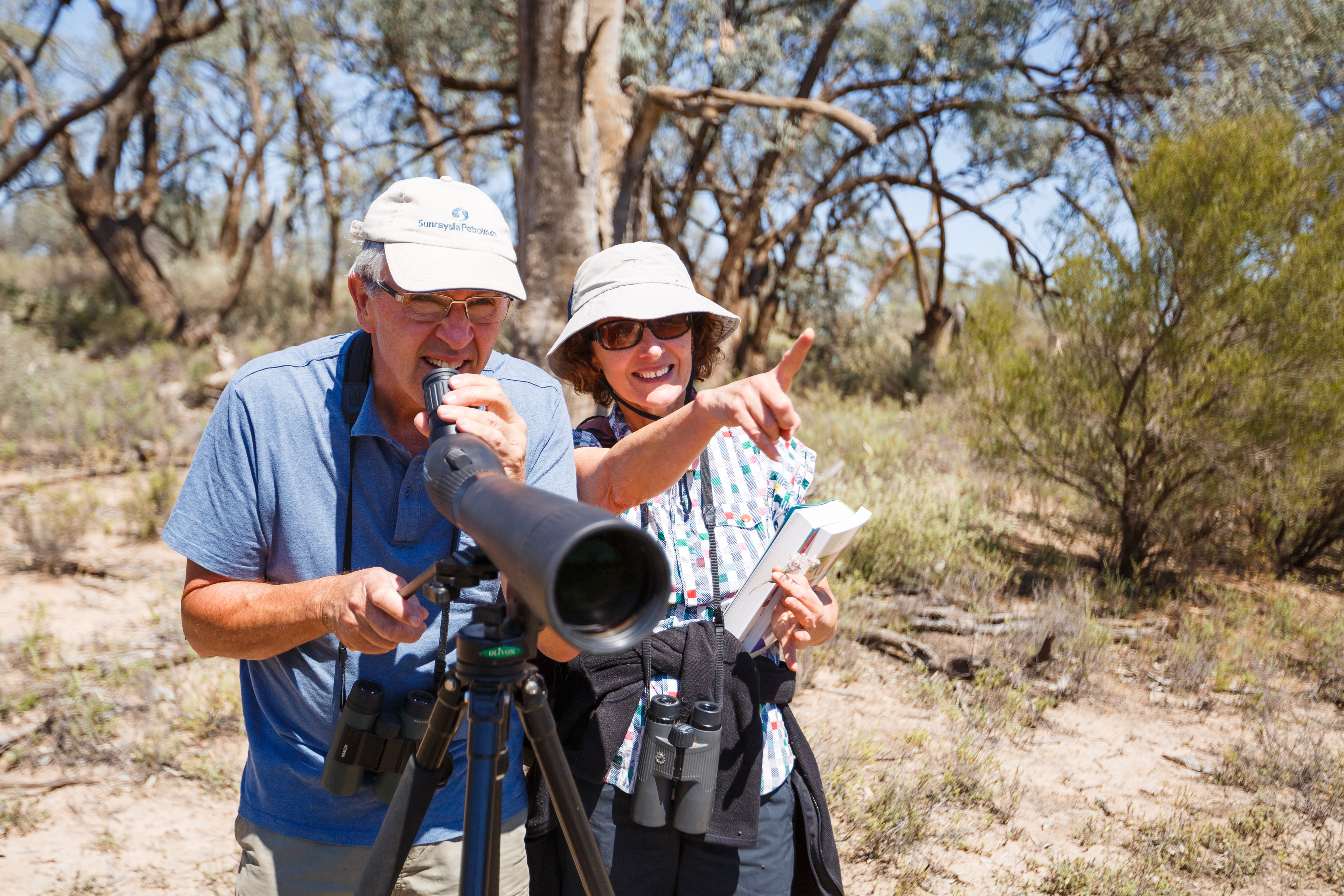
First Nations from many parts of the Southern Connected Basin gather regularly in solidarity to share information between Nations about the health of Country and discuss our water objectives and inherent rights.

This includes our desired outcomes from the management of environmental water on our Countries. In 2021 we agreed to contribute a collective statement about environmental water use. Our statement is a living document. It will grow and adapt overtime as the social, political, and climate pressures facing our people and Countries evolve.

We first gathered in April 2021, on Latji Latji Country in Mildura, and subsequently online in November 2021 and again on Ngunnawal Country in Canberra in April 2022.

We want water holders, managers and decision makers to hear these key messages:

Respect water, Country and lore

First Nations are endeavouring to guide and collaborate with Government agencies to improve river health. But the inherent risks of the settler – colonial water management systems, that have been imposed on our Countries, must be addressed. The current water regime in the Murray-Darling Basin ignores the principles and knowledges that underpin our practices of caring for Country.

Water can never be ‘owned’. Water and rivers have life and spirit which cannot be bought and sold. All ‘ownership’ of water in this Country is based on the dispossession of First Nations and imposition of colonial legal frameworks. We have never ceded our inherent rights as guardians and caretakers of rivers and waters including our groundwaters. First Nations lore provides a holistic, interconnected management system, where all elements contribute to the good of the whole.

We want to collaborate, but we do not accept or endorse the legal and management frameworks that have been imposed on our rivers and groundwaters. We ask our partners to respect our water spirits, knowledge and lore.

Address our concerns

We have major concerns about the legal, policy and governance settings that dictate how our rivers flow and how we get a voice. These include:

  • Overallocation of water and water allocation decisions which do not leave enough in our rivers or groundwaters to sustain their survival or meet our cultural needs
  • Over reliance on damaging infrastructure to regulate and replicate complex natural systems, with little real benefit to our Countries
  • Short term decision making that doesn’t properly account for a changing climate
  • Limited commitment to and resourcing for First Nations participation and empowerment
  • Decision making that excludes First Nations’ rights and interests
  • Commodification and trading of water that disregards the limitations of natural systems
  • Water theft and illegal extraction
  • Inequitable access to water and poor distribution of the social and economic benefits it can bring

The settler-colonial water framework has generated perverse outcomes which we contend with on a daily basis. The mindset of water management needs to change. Reform of Federal, State and Territory legislation and policy is a must in pursuance of First Nations principles for a sustainable interconnected Murray Darling Basin system.

Recognise that our rivers are at risk

We see examples where environmental water is helping to heal Country, but the overall policy and legal settings mean our waterways and cultural values are at risk.

Our biodiversity is suffering. We are struggling to save remnants of our ecologically and culturally significant landscapes. We are being asked to prioritise some places, while we watch others decline or die. We are grappling with this reality.

Infrastructure, including dams, weirs, regulators and pumps, is segmenting our waterways and damaging our Country with little real benefit. There is too much regulation of the floodplain and huge investment in infrastructure without proper engagement with our people.

Fluctuating river levels and unseasonably high flows, driven by consumptive demand, are degrading our waterways and cultural values. Land use is driving unsustainable water demands and limited channel capacity means we can’t get water to where we need it when it is needed.

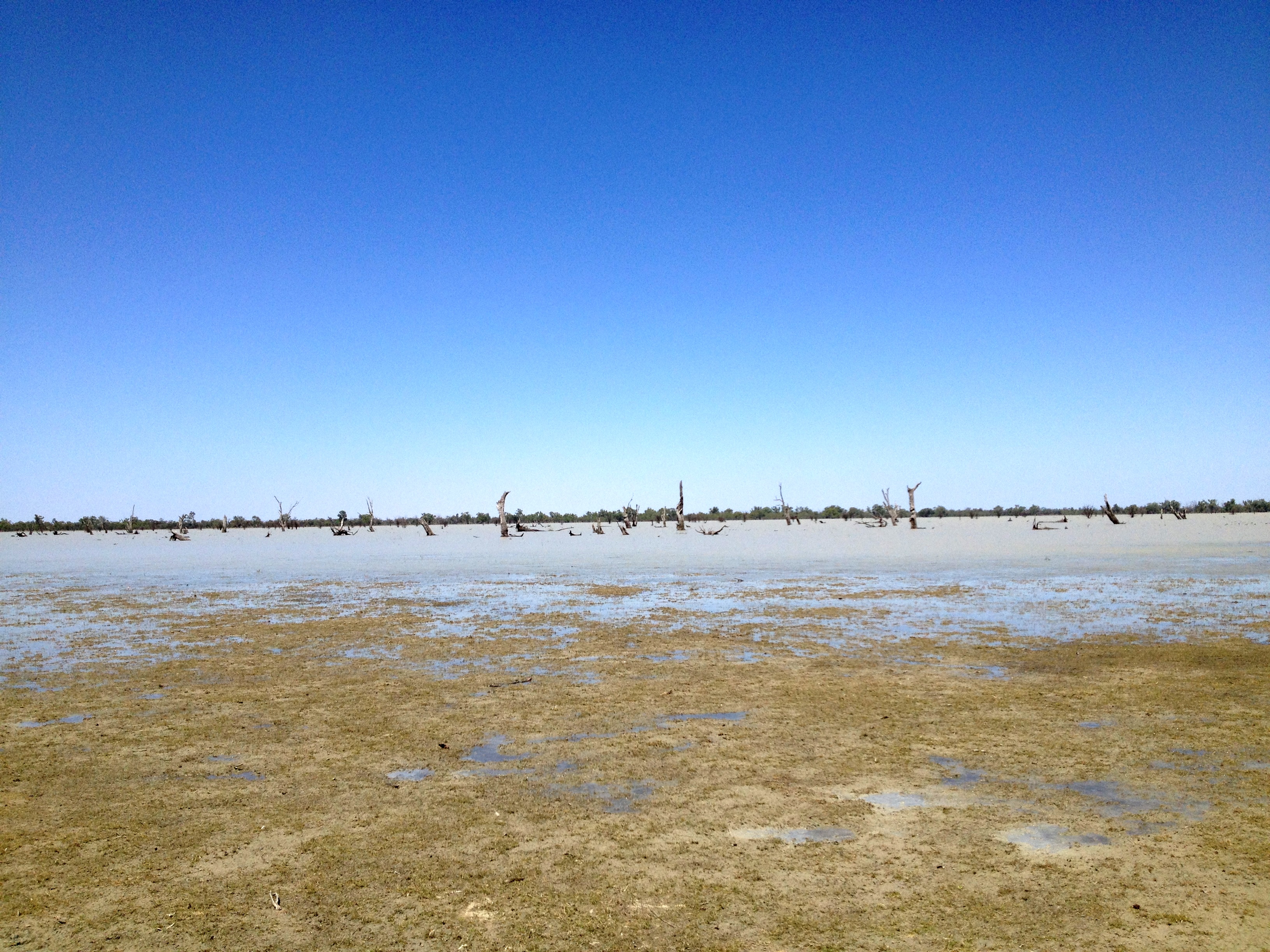
Water holes are silting up. Bank erosion and slumping is causing huge impacts on cultural heritage.

Poor water quality, algal blooms and salinity are being compounded by the disruption of natural systems that flush and clean our rivers and wetlands. Waterways, creeks and wetlands are being left to dry out, exposing cultural sites and degrading cultural values.

The health of significant trees and medicinal plants is declining because of lack of water, impacting on our cultural sustainability, health and wellbeing. Culturally significant birds and animal species are not seen where they used to be. There are not enough native fish in the system.

Delivering water to our wetlands and billabongs through artificial systems can mean delivering the wrong water for Country. Legal and infrastructure constraints restrict us from being able to direct water to where we need it.

Help us protect and grow the things that are important to us.

We are passionate about working together to protect and sustain our waterways.

We need the agency and life force of the river to be respected. We want to see more water going out onto Country and filling all our creeks and billabongs. We want water holders and managers to work with us, looking at the whole system and how to restore it to what it was, with adequate flows and proper timing. We want overbank flows to support total system health.

We want increased recovery of water for the environment, not decreased.

We want to see the Murray Mouth open and salt being flushed from the system.

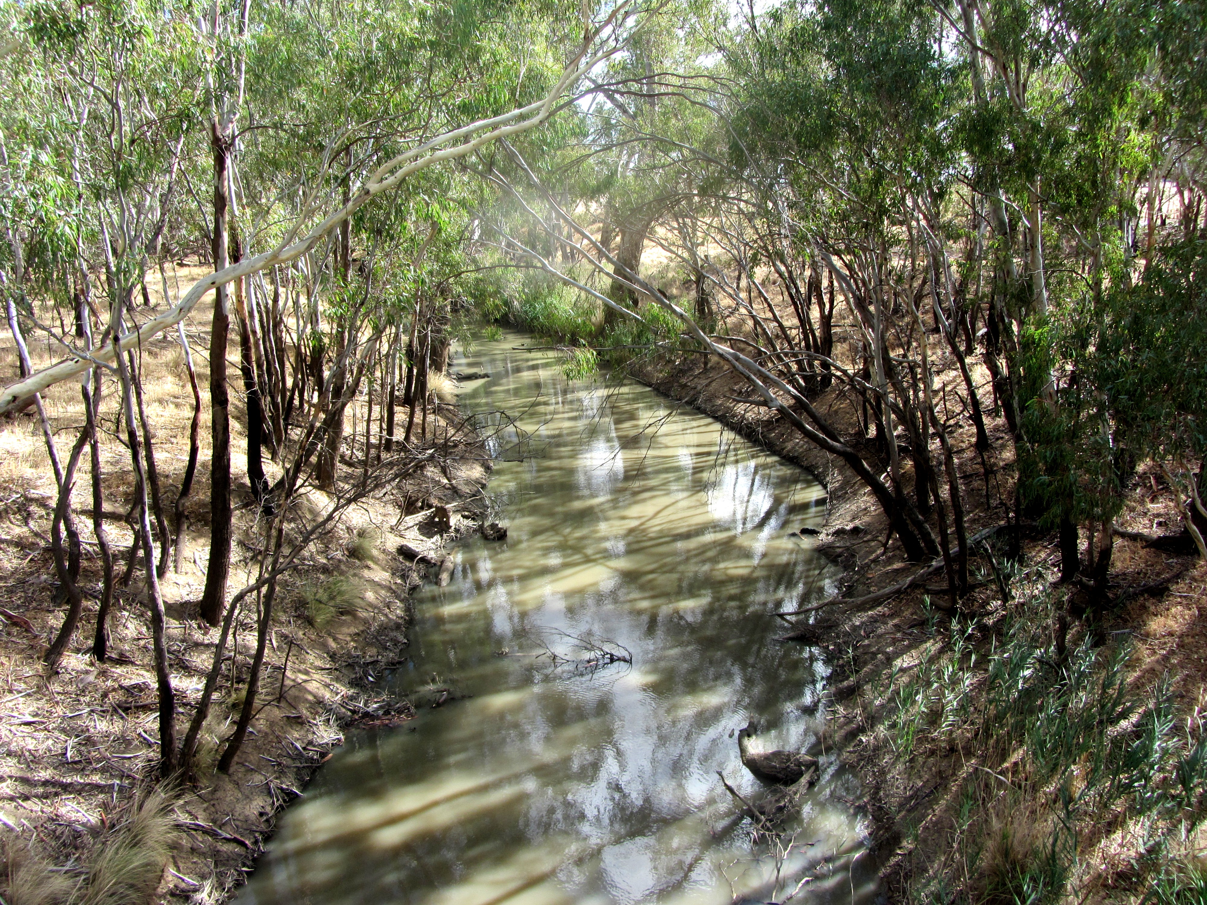
We want the lakes, billabongs, creeks, wetlands and rivers that are important to us to get the water they need to thrive. We want to see dry and degraded wetlands restored to life with culturally informed watering to protect our cultural, spiritual and heritage values.

We want regular re-connecting flows from floodplains and billabongs, allowing the life in our natural nurseries to restock and replenish the river. We need adequate, sustained flows through our rivers to keep them connected and mitigate variation from irrigation demand.

We want healthy water to flow into, around and through our Country to all mobs downstream. We want the nutrition and healthy water from upstream to replenish Country. We want to build back biodiversity and Traditional Owner management to improve water quality. We want to collaborate with all mobs to ensure a healthy system, renewing cultural connections between Nations.

We need to exercise self-determination over the development and operation of infrastructure on Country. We want to be empowered to use our natural and cultural infrastructure, billabongs, fish traps and breeding structures, to slow down flows and recharge the landscape.

We need adequate healthy water for improved tree health and thriving floodplain forests with Red gum, Black box and Yellow box.

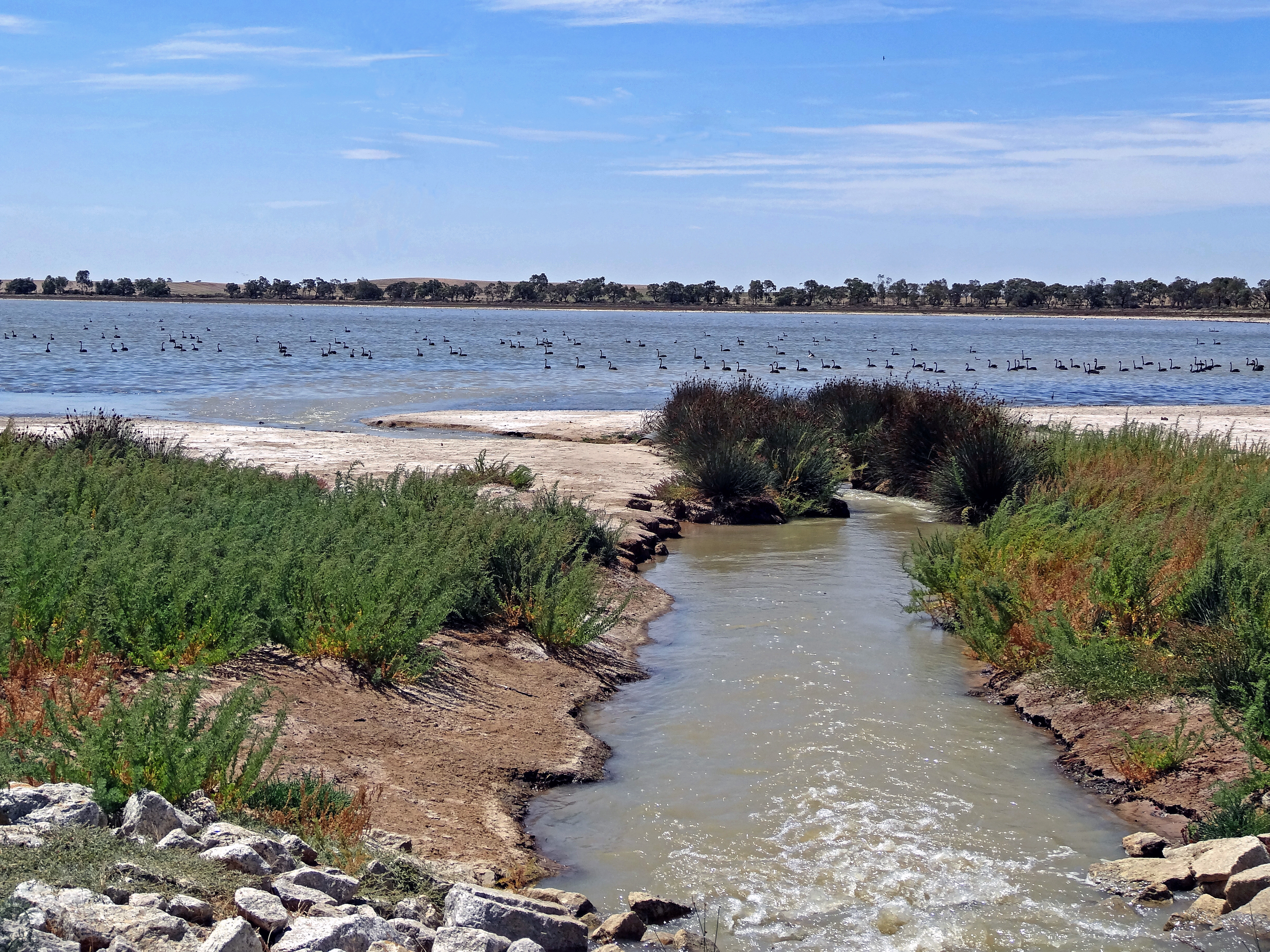
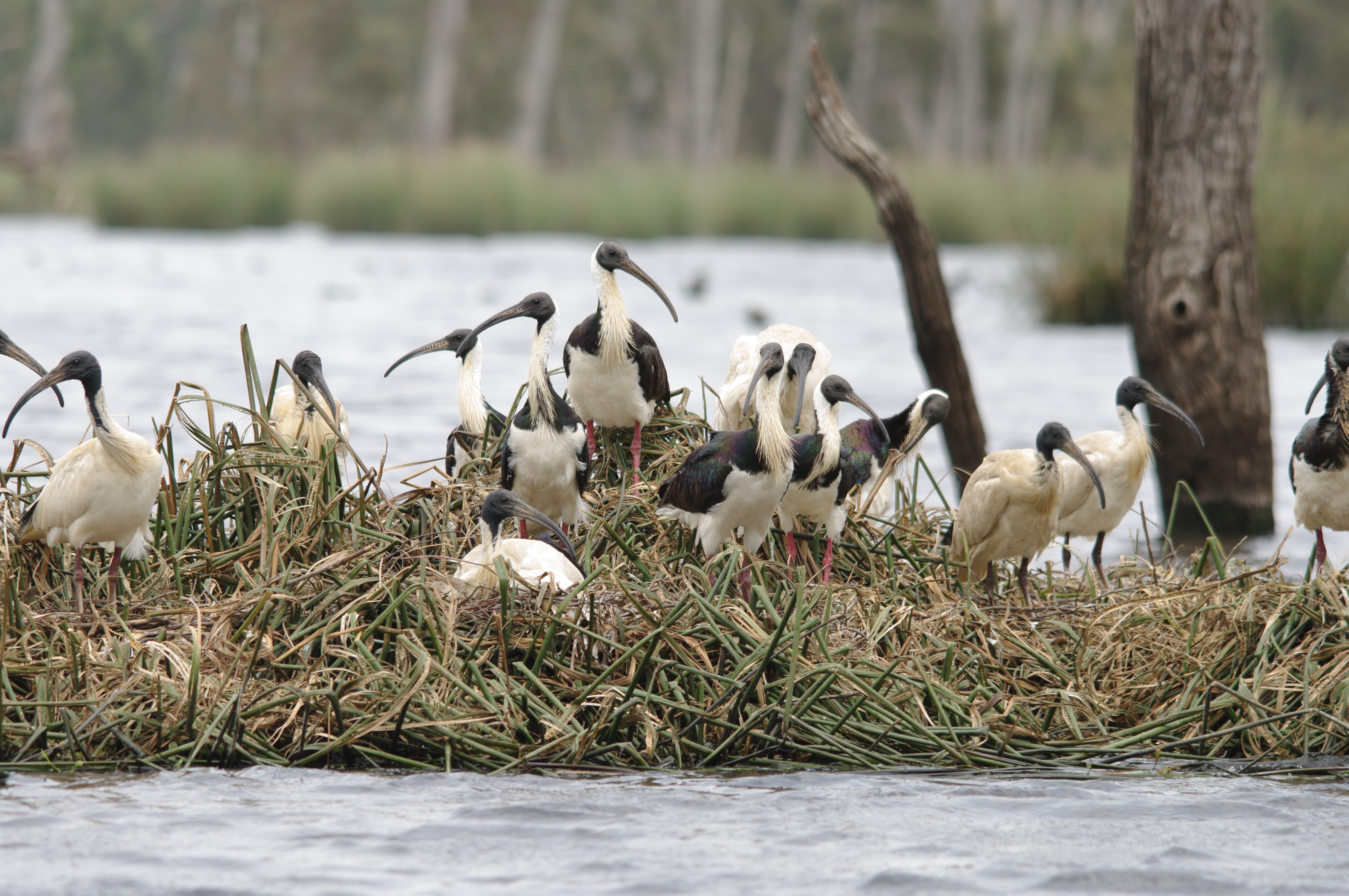
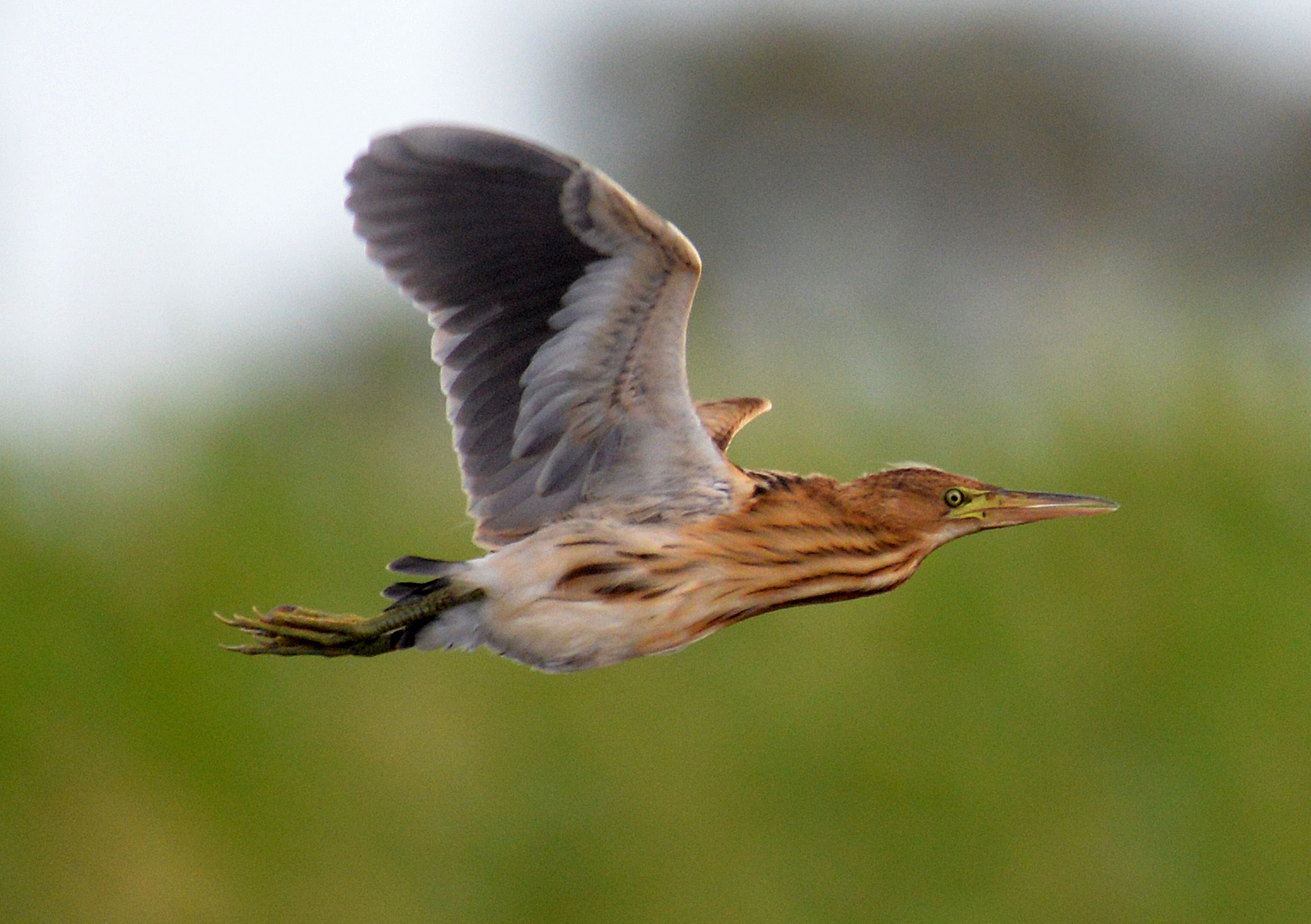
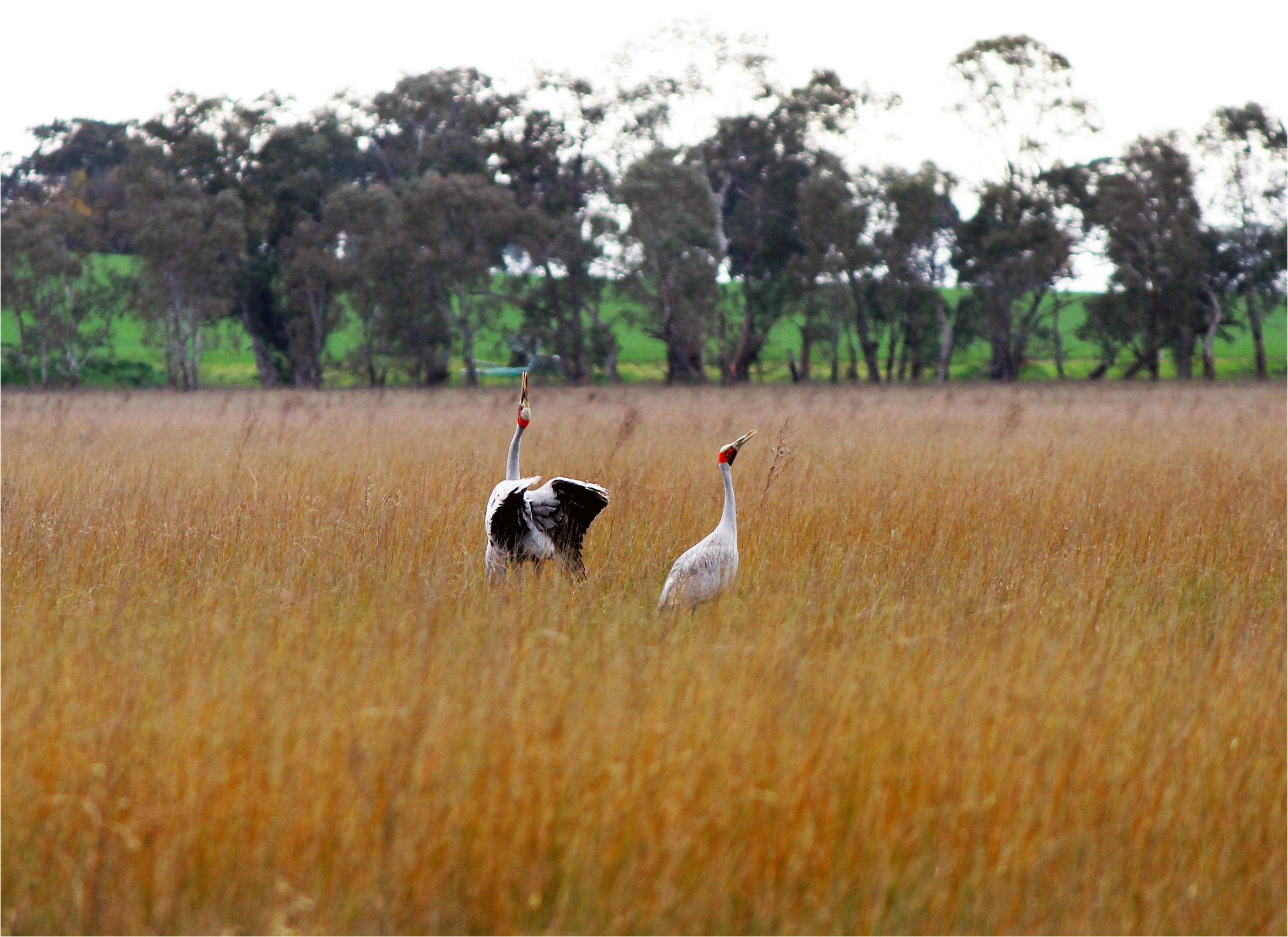
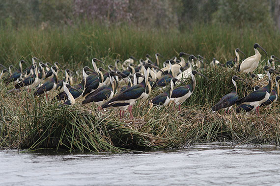
We need flows to replenish the floodplain and support our important cultural plants like Old man weed, grasses and sedges, Nardoo, Cumbungie and milfoil. We want to see water birds, ducks, swans and Brolgas, returning and thriving in our wetlands.

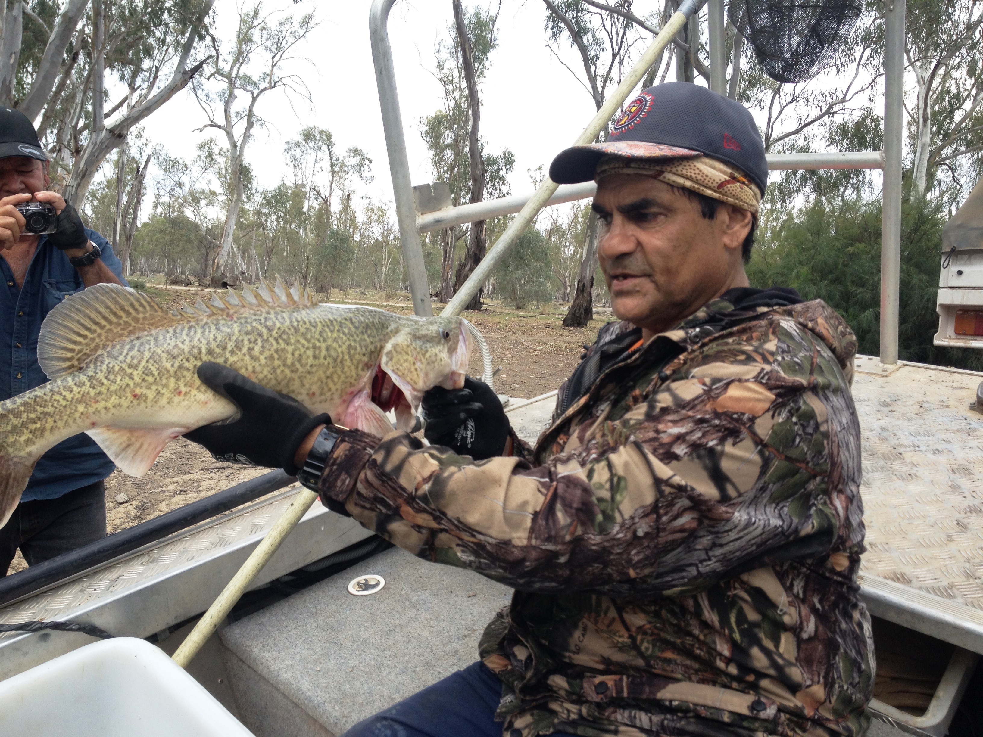
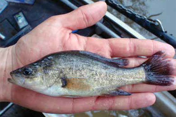
We need connectivity and good water quality to support native fish including Black bream, Congolli, crayfish, mussels, small bodied fish, shrimp, Shield shrimp, yabbies, Yellow belly, Murray cod, catfish, Black fish, Murray hardyhead and Trout cod. We want turtles, Platypus, frogs and all the other animals that rely on water to be able to return to Country.

We want co-management of all environmental water. We want to be empowered to make the decisions about how environmental water is used. Prioritisation and water planning should be driven from the ground up, by First Nations. Give us control and we will show you how to heal Country and, in doing so, we will maintain intergenerational transfer of knowledge.

We want water managers to listen deeply to what Traditional Owners and Elders have to say and to help us access your science to back our objectives (not the other way round).

We need policy changes, transparency and reviews of the existing entitlement system. We need to review and amend the Basin Plan to reflect our knowledge, science and human rights. We need Traditional Owners involved in the highest level of all Government agencies and we need our own agencies and statutory bodies.

Sufficient and recurrent resourcing is a necessity for First Nations to undertake First Nations led risk assessments on agencies and their practices, as well as monitoring outcomes of any environmental watering undertaken within the Murray Darling Basin.

Stories

Stories of success and reflections on past environmental watering activities and results

Page last updated: 24/07/21